Campground photo 1
Campground photo 2
Campground photo 3

Top Equestrian Camping near Gypsum, CO

Looking for a rustic and comfortable horse camping experience near Gypsum? It's easy to find Gypsum equestrian campgrounds with the Dyrt. These scenic and easy-to-reach Colorado campsites are perfect for your horse camping excursion.

Best Equestrian Camping Sites Near Gypsum, CO (17)

  1. Camper-submitted photo from Four Mile Road Dispersed
  2. Camper-submitted photo from Bear Lake Campground

    2.

    Bear Lake Campground

    12 Reviews
    36 Photos
    291 Saves
    Yampa, Colorado

    Managed by the Yampa Ranger District. This campground is located in the Bear River area of the Flat Tops Wilderness, 14 miles southwest of Yampa on Forest Development Road 900. This campground is in a large wooded area that makes a small loop with 43 sites + 4 double sites and 1 triple site making it a popular place for RV’s and families with children.

    • Pets
    • Fires
    • ADA Access
    • RVs
    • Tents
    • Group

    $5 / night

  3. Camper-submitted photo from Avalanche Campground

    3.

    Avalanche Campground

    9 Reviews
    21 Photos
    398 Saves
    Redstone, Colorado

    Avalanche Campground has 6 first-come first-serve campsites. It is located adjacent to Avalanche Creek. Fishing is available in Avalanche Creek and in the Crystal River, which is 3 miles downstream. One of the major trailheads into the Maroon Bells-Snowmass Wilderness is located adjacent to the campground.

    • Pets
    • Fires
    • Phone Service
    • RVs
    • Tents
    • Group
  4. Camper-submitted photo from Lakeview Campground

    4.

    Lakeview Campground

    17 Reviews
    67 Photos
    324 Saves
    Granite, Colorado

    Overview

    Lakeview Campground, with wonderful views of the Twin Lakes Reservoir, is located about 20 miles south of Leadville, Colorado. The campground attracts many hikers looking to explore nature and the hiking trails in the surrounding area. Boaters can launch their craft at the nearby boat dock and fishing enthusiasts can find numerous locations at Twin Lakes Reservoir for fishing.

    Recreation

    The Continental Divide Trail, which runs from Canada to Mexico, is a non-motorized trail that passes Lakeview Campground. Mountain bikes are allowed in the section from Halfmoon Road south to Twin Lakes. Approximately 300 miles of the trail goes through Colorado. South of the campground lies Twin Lakes, Colorado's largest natural glacier lakes. Sailing and water skiing are among the popular activities here. Fishing includes lake, rainbow and mackinaw trout.

    Facilities

    This campground has single family sites. Each site is equipped with a picnic table and campfire ring. Vault toilets and trash collection are provided. Firewood may be purchased at the Host site.

    Natural Features

    Lakeview is situated in a ponderosa pine and sage habitat at an elevation of 9,500 feet. The site is between Mt. Elbert Forebay and Twin Lakes. The Twin Lakes Reservoir spans 2,805 acres and Mount Elbert stands tall at 14,433 feet. To the north is the Mount Massive Wilderness area, 30,540 acres encompassing Mount Massive, Colorado___s second highest peak at 14,421 feet. To the south is the Collegiate Peaks Wilderness with 8 peaks over 14,000 ft high. Much of the wilderness is above timberline with many alpine plant communities and permanent snowfields.

    Nearby Attractions

    The Top of the Rockies Scenic Byway leads to Independence Pass, one of the highest paved passes in Colorado. The historic mining town, Leadville, is a half hour away.

    Charges & Cancellations

    Cancellations Individual Campsites: Cancellations up to 2 days before a reservation start date incur a $10.00 cancellation fee.__ A visitor who cancels a reservation the day before or on the day of arrival will pay a $10.00 service fee AND forfeit the first night's use fee including tax and applicable add-on for a campsite. Cancellations for a one-night reservation will forfeit the entire amount paid and will not be subject to an additional service fee. No-Shows A no-show visitor is one who does not arrive at a campground and does not cancel the reservation by check-out time on the day after the scheduled arrival date. Staff will hold a campsite until check-out time on the day following the arrival date. No-shows are assessed $20.00 service fee and forfeit the first night's rate, taxes and applicable add-on for a campsite.____ Refunds Visitors may submit a refund request through their Recreation.gov profile within 7 days of the end date of their reservation. Refunds will not be issued after the 7 days has ended. Refunds for debit or credit card payments will be issued as a credit to the original bank or credit card used to pay. For check or cash purchases, Recreation.gov will mail a Treasury check for refunds of cash, check, or money order payments to the address associated with the reservation. Treasury check refunds may take up to 6-8 weeks to arrive.__ In the event of an emergency closure, the Recreation.gov team or facility manager will refund all fees and will attempt to notify you using the contact information within the Recreation.gov visitor profile.

    • Pets
    • Fires
    • Phone Service
    • RVs
    • Tents
    • Group

    $26 / night

  5. Camper-submitted photo from Trappers Lake Horse Thief Campground

    5.

    Trappers Lake Horse Thief Campground

    3 Reviews
    3 Photos
    49 Saves
    Yampa, Colorado

    Trappers Lake is known as the "Cradle of Wilderness." At approximately 302 surface acres, the lake contains a strain of native cutthroat trout and the Colorado Division of Wildlife operates a spawn collection station at the Cabin Creek inlet during May and June. Trappers Lake itself lies completely within Flat Tops Wilderness; motorized boats and wheeled carts for boat transport are prohibited. Trappers Lake Lodge rents cabins and boats, and there are 5 Forest Service campgrounds nearby. Dispersed camping is prohibited within 1/4 mile of Trappers Lake and the campgrounds. The video below is provided courtesy of Flattopsbyway. A downloadable audio tour of the Flat Tops Trail Scenic and Historic Byway is also available.

    • Pets
    • Fires
    • ADA Access
    • RVs
    • Tents
    • Group
  6. Camper-submitted photo from Radium Recreation Site

    6.

    Radium Recreation Site

    2 Reviews
    13 Photos
    47 Saves
    Bond, Colorado

    Overview

    Managed By Kremmling Field Office__ The Radium Recreation Area is part of the Upper Colorado River Special Recreation Management Area (SRMA), providing opportunities for developed camping and river access. With over 100,000 annual visitors the sites facilities include 2 developed boat ramp sites, 9 vault toilets, day use and overnight parking, 16 single campsites and 2 Group Campsites and 3 day use shade structures. There is no potable water provided at this area. The area is used by visitors to access the river for floatboating and fishing opportunities.____

    Recreation

    Recreation opportunities include river access for fishing and floatboating. On-site picnic shelters provide visitors with opportunities to a covered area for relaxing and picnicking. Note ___ Radium Warm Springs Access: There are no designated trails from this area and there is no designated access to the Radium Warm Springs. Parking is not permitted along the narrow Radium Road between the Radium Recreation Area and Trough Road to ensure safe passage of vehicles and ensure clear passage for Emergency Vehicles when needed. Please respect the social trail closures and restoration conducted on BLM managed lands along Radium Road that protect area wildlife habitat including area Big Horn Sheep. The Colorado Parks and Wildlife Mugrage Site along Radium Road, including the restroom and social trail that accessed the Radium Warm Springs within the Radium State Wildlife Area, is closed for the protection of this important habitat. The BLM is looking at a potential future designated and developed trail from the Radium Recreation Area.__ Until a trail alignment along Radium Road is developed it is recommended that the easiest and safest way to access the Radium Warm Springs from Radium Recreation Area is to drive to Warm Springs Road 1.5 northeast along Trough Road. Follow the directional sign located at the intersection of Radium Road and Trough Road. A parking area and trailhead at the end of Warm Springs Road provides access to the Radium Warm Springs via the Warm Springs Trail open to foot travel only, or the Ol___ Warm Springs Trail which is open to Foot, Horse, Bicycle and eBike travel.__

    Facilities

    Each campsite must be reserved through Recreation.gov and has varying space for parking (see parking size limitations before completing your reservation), a picnic table, a fire ring, and close proximity to a vault toilet and trash receptacles. Campsites 1-4 are walk-in sites and have parking for one vehicle without a trailer. Campsites 5-13 have pull through parking areas and can typically fit one to two vehicles and small trailers. Campsites 14-16 have pull in parking and is 30 feet in length or less. Additional vehicles not fitting within a campsite's designated parking must park in the general parking areas. There are no electric hook-ups and cell service non-existent without a booster. There are two boat ramps with restrooms.__

    Natural Features

    The Radium Recreation Area is adjacent to the Colorado River next to the small town of Radium. The scenery within the area is a major component to the adjacent Colorado Headwaters National Scenic and Historic Byway and are important features that make this stretch of river Wild and Scenic Eligible.

    Nearby Attractions

    The town of Kremmling, CO is approximately 20 miles east from Radium Recreation Area where visitors can get supplies. Rancho Del Rio ___ a private resort along the Colorado river, has a small store with supplies and is a river access point for those recreating on the river. Rancho Del Rio is located approximately 6 miles west along Trough Road. Trough Road, which accesses the BLM Recreation Areas and Rancho Del Rio (private river access ___ fee site) is the Colorado Headwaters National Scenic and Historic Byway. Originating just east of Grand Lake on Highway 34, the byway ends at State Bridge.__

    • Pets
    • RVs
    • Tents
    • Group
    • Equestrian
    • Standard (Tent/RV)

    $30 / night

  7. Camper-submitted photo from North Fork

    7.

    North Fork

    4 Reviews
    11 Photos
    21 Saves
    Meeker, Colorado
    • Pets
    • Fires
    • Reservable
    • RVs
    • Tents
    • Equestrian
  8. Camper-submitted photo from South Fork Campground

    8.

    South Fork Campground

    2 Reviews
    8 Photos
    46 Saves
    New Castle, Colorado

    The South Fork Campground provides good access to fishing on the South Fork of the White River, and hiking & horseback riding in the Flat Tops Wilderness. This site provides access to South Fork Trail #1827and Spring Cave Trail #1834. Overflow camping is available (regular fees apply).

    • Pets
    • Fires
    • RVs
    • Tents
    • Equestrian
    • Standard (Tent/RV)

    $20 / night

  9. Camper-submitted photo from East Marvine

    9.

    East Marvine

    2 Reviews
    9 Photos
    22 Saves
    Meeker, Colorado

    The East Marvine Campground has 7 non-reservable campsites with picnic tables, toilet, firegrates, and trash disposal. The campground adjacent to East Marvine Trail #1822 and Marvine Trail #1823. Nearby fishing is available at East Marvine Creek, Marvine Creek, Marvine Lakes, Rainbow Lake & Guthrie Lake. The Marvine parking areas provide plenty of room for trailers and vehicles. Hitchracks are available in the parking lot, and corrals are available at a charge of $5.00 each, per day. Day use parking is available on the right side of the road and overflow camping (when the campgrounds are full) is available on the left side of the road (regular fees apply). Domestic cattle may be grazing in this area. There is no potable water available. Livestock may be watered in the stream, approximately 400 yards away.

    • Pets
    • Fires
    • Reservable
    • RVs
    • Tents
    • Equestrian
  10. Camper-submitted photo from Marvine Campground

    10.

    Marvine Campground

    1 Review
    9 Photos
    13 Saves
    Meeker, Colorado

    Overview

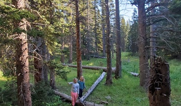
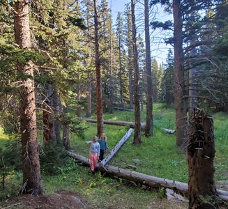
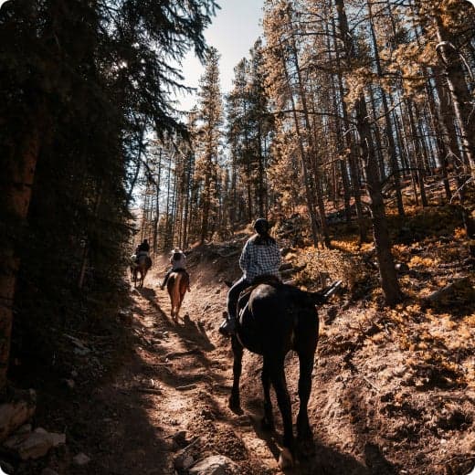
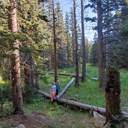
    Marvine Campground is set in a towering grove of mixed conifer and aspen trees on the western slope of the Colorado Rockies at an elevation of 8,200 feet. This is an ideal setting for guests seeking recreation and relaxation. Hikers, hunters, anglers and equestrians can also find recreational opportunities nearby. This is a good base for hiking and horseback riding in the Flat Tops Wilderness. Enjoy elk hunting amidst one of the largest elk herds in North America.

    Recreation

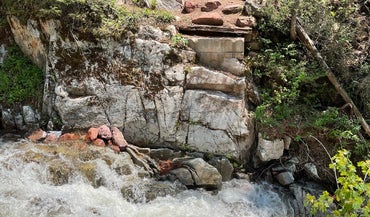
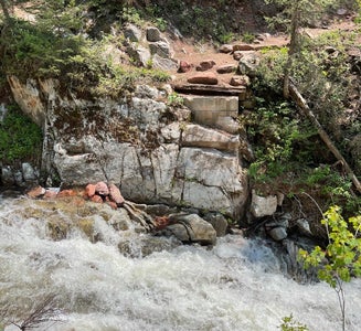
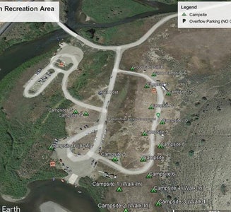
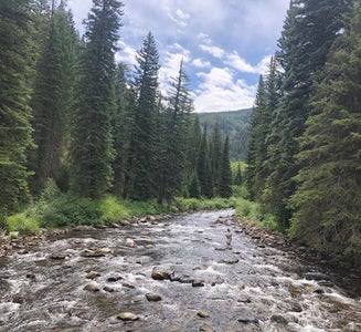
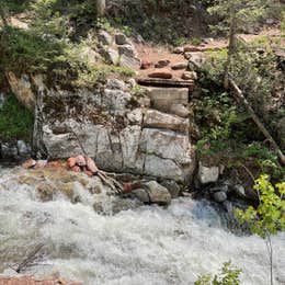
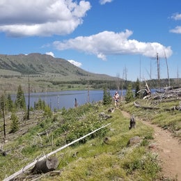
    This popular campground is located 36 miles east of Meeker along Marvine Creek. It offers access to a number of trails and lakes for hiking, fishing and hunting. Fishing is available in Marvine and East Marvine Creeks, and in the Flat Tops Wilderness at Marvine Lakes. Marvine Trail #1823 and East Marvine Trail #1822 both begin near the campground.
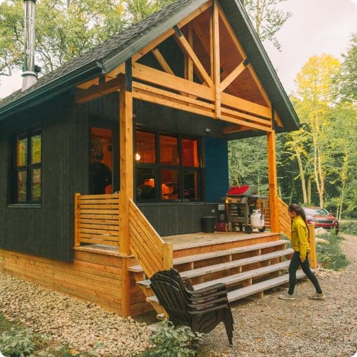
    Facilities

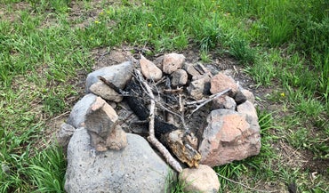
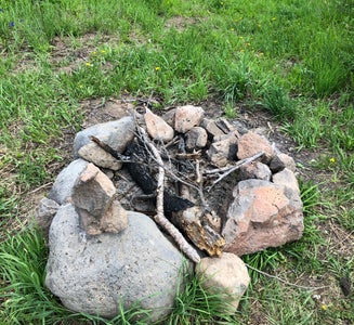
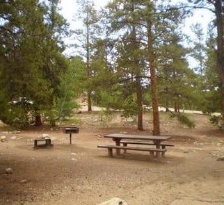
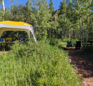
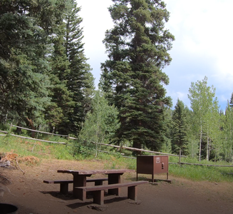
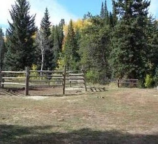
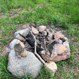
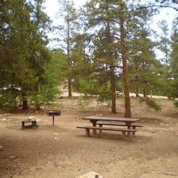
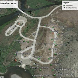
    Marvine Campground has six horse campsites. The only corrals available for public use are the ones at the horse camp sites in the campground. The corrals at the Marvine Trailhead are for Outfitter and Guide use only. Additional facilities at the campground include tables, fire grates, vault toilets and hand pump drinking water. Trash service is provided. Electrical hook-ups are not available. Livestock may be watered in the stream, about 200 yards from the campground.

    Natural Features

    In the heart of the Rocky Mountains, the 2.3 million acre White River National Forest is a place of serenity and adventure, boasting 8 wilderness areas, 4 defined seasons, and 10 peaks surpassing 14,000 feet in elevation. Wildlife in the area abounds. Bighorn sheep navigate rocky ridges, moose graze along the streams and bull elk bugle at dusk. Scenic rivers sustain populations of cutthroat, rainbow, and brown trout. Alpine regions provide habitat for pika and ptarmigan. These species, along with many others, depend on surrounding undeveloped wilderness, clean streams, and diverse forests to live.

    contact_info

    For facility specific information, please call (801) 226-3564.

    Nearby Attractions

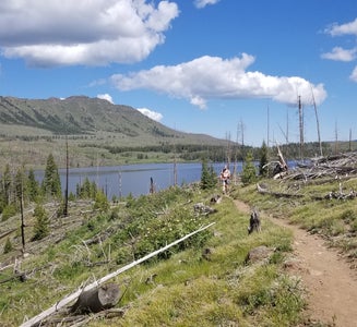
    East Marvine Trail: The trail leads up East Marvine Creek, through the the Flat Tops Wilderness to Johnson Lake. At the summit Big Marvine Peak offers a panoramic view of the Flat Tops Wilderness and surrounding area. Marvine Trail: The Marvine Trail begins at the end of County Road 12 right outside the campground. It accesses Marvine Creek and Marvine Lakes providing great opportunity to fish. Marvine Lake and Slide Lake: These two lakes cover 135 surface acres and offer rainbow, brook and cutthroat trout fishing. Marvine Lakes General Forest Area: The Marvine Lakes general forest area offers access to a number of lakes and trails in the central part of the Flat Tops Wilderness Area of the White River National Forest. Papoose Trail: Papoose Creek Trail 2248 leads up Papoose Creek past several short waterfalls, to Papoose Basin. It then climbs onto the Flat Tops Plateau where it intersects the Oyster Lake Trail 1825.

    Charges & Cancellations

    Once your reservation start date has begun, neither the Recreation.gov Contact Center nor the campground manager will be able to modify your reservation.

    • Pets
    • Fires
    • RVs
    • Tents
    • Equestrian
    • Standard (Tent/RV)

    $32 - $34 / night

Showing results 1-10 of 17 campgrounds

Popular Camping Styles near Gypsum

Pet-friendly camping near Gypsum

Recent Equestrian Reviews In Gypsum

79 Reviews of 17 Gypsum Campgrounds