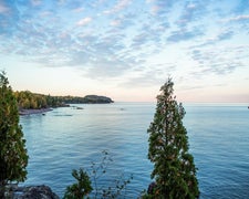
Description
Dotted with about 200 undeveloped islands, the Chippewa Flowage is Wisconsin's third largest lake and boasts a highly irregular, wooded, and generally undeveloped 233-mile shoreline. Boat-in to camp at one of several primitive campsites or explore the seemingly endless maze of islands, points, bays floating bogs and channels. All state campsites are accessible by water only. One state campsite can be reserved by people with disabilities by contacting the property office; all other state campsites are non-reservable. The U.S. Forest Service and Lac Courte Oreilles Conservation Department also have designated campsites on the Flowage.
Warning 1 Alert is In Effect
There is 1 alert for this campground. Camp safely!
Warning 1 Alert is In Effect
There is 1 alert for this campground. Camp safely!
DNR campsites on the Chippewa Flowage must be reserved for camping from May 1 through November 30. Outside the reservation season the department cannot guarantee campsite access or availability.
RV Road Trip Guides

Map & DirectionsChippewa Flowage Boat-In Sites is located in Wisconsin near Winter
Directions
The Chippewa Flowage is in central Sawyer County, about 15 miles east of Hayward. The area has many maintained access roads with parking areas that connect to town roads. Campsites and boat launches are found throughout the flowage.
Coordinates
45.9069248 N
91.1089344 W
Access
- Boat-InSites accessible by watercraft.
Site Types
- Tent Sites
Features
For Campers
- Picnic Table
- Reservable
- Pets

