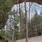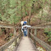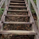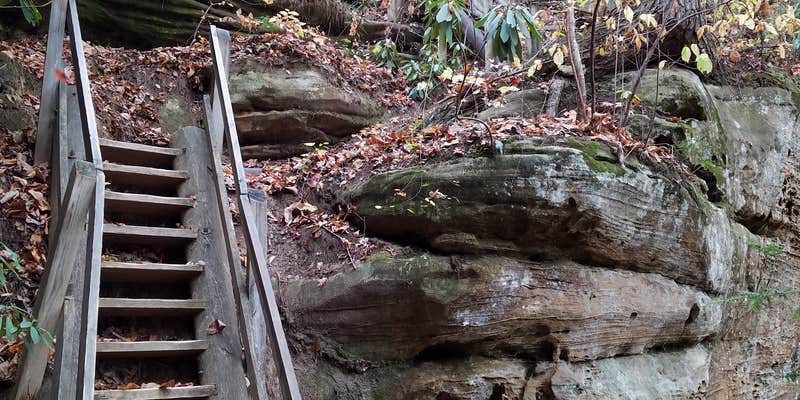
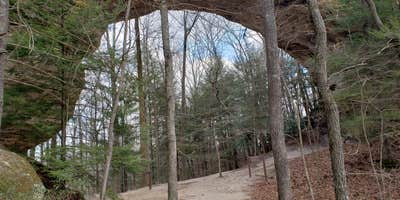
Big South Fork National River and Recreation Area manages this hike-in backcountry camping within its forested canyon terrain, where sites are self-selected along trails and near creek and river corridors. There are no designated pads or hookups. Nightly fees run $5 to $25, campfires are permitted, and pets are welcome. Campers heading in from the Twin Arches Loop trailhead should expect steep descents into the canyon, including stair sections that require sure footing and a loaded pack. Permits are required on-site. For pet-friendly camping near Big South Fork National River and Recreation Area, Bandy Creek Campground provides a developed alternative with more amenities. Late March conditions can include ice in shaded overhangs, so check temperatures before committing to a shoulder-season trip.
Description
Hunters, mountain bikers, horseback riders, paddlers, and backpackers enjoy roughing it in the backcountry of Big South Fork National River & Recreation Area. Please help protect our public lands and enhance the backcountry experience for all by using minimum impact techniques and observing all regulations.
BACKCOUNTRY SITES Backcountry camping is defined as any camping outside of a developed area. Although there are no designated backcountry sites, you can help minimize impact by using an existing site rather than creating a new one. No campsite shall be left unattended for more than 24 hours.
Camping is not permitted at a location within 100 feet of the centerline of or visible from any paved road.
No camping is permitted at developed parking areas. Camping is allowed near developed parking areas when the campsite is at least 100 feet from the parking area and is not visible from the parking area. Camping is not allowed within 300 feet of the Leatherwood Ford day use area north of the Leatherwood Ford parking area.
Developed parking areas are those designated by the 2005 General Management Plan and/or as signed: Yahoo Falls, Alum Ford, Yamacraw, Blue Heron Overlooks, Blue Heron and access areas along river, East Rim Overlook, Leatherwood Ford, West Entrance, Charit Creek, Twin Arches, Burnt Mill Bridge, Peters Bridge, Bear Creek Overlook, Brewster Bridge, and Honey Creek Overlook.
In addition all areas immediately adjacent to the East Bandy Creek Road, from State Hwy 297 west to Scott State Forest and West Bandy Creek Road to Scott State Forest, are closed to camping (This area is otherwise known as the Bandy Creek Fee Area).
Fee Info
REGISTRATION Backcountry camping permits are required. You may obtain a permit from one of the parks’ visitor centers, or online at http://www.nps.gov/biso/planyourvisit/permits.htm. Permits are valid for a single camping trip not to exceed 14 days at one site. No person, party, or group shall be permitted to camp for more than a total of 30 days in a calendar year. For more information, please call (423) 286-7275.
RV Road Trip Guides

Map & DirectionsBackcountry Camping is located in Tennessee near Oneida
 Public Campground
Coordinates
36.534808155757865 N
84.66526318643702 W
Connectivity
 T-MobileNo Coverage
- VerizonNo Coverage
- AT&TNo Coverage
Connectivity
- T-MobileNo Coverage
- VerizonNo Coverage
- AT&TNo Coverage
Access
- Walk-InPark in a lot, walk to your site.
- Hike-InBackcountry sites.
Site Types
- Tent Sites
- Dispersed
Features
For Campers
- Pets
- Fires
Drive Time
- 1 hr 24 min from Knoxville, TN
- 2 hrs 3 min from Morristown, TN
- 2 hrs 21 min from Lexington, KY
- 2 hrs 28 min from Cleveland, TN