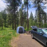
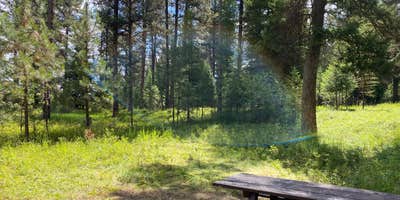
Within Whitman National Forest, Bird Track Springs operates as a basic Forest Service campground that draws campers seeking affordable access to the Grande Ronde River corridor. The $5-10 nightly fee covers spacious sites under tall conifers, with vault toilets and picnic tables but no water or trash service.
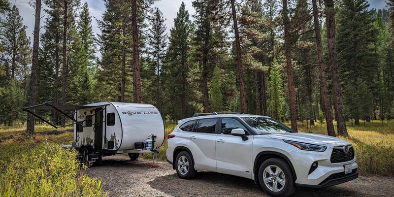
Sites accommodate both tents and RVs, with several reviewers noting easy backing for larger rigs despite the forest setting. The campground spreads sites well apart under what one visitor described as "lots of very tall swaying trees," providing natural shade throughout most areas. Road noise from the nearby highway reaches some sites, though campers report it diminishes at night when wildlife sounds take over—coyotes frequently howl between midnight and 3 AM.
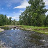
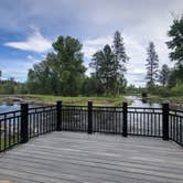
Access to the Grande Ronde River sits within walking distance, making this a practical base for anglers and paddlers. Cell coverage reaches the campground with some carriers reporting two bars of service. The Forest Service maintains vault toilets year-round, though winter access requires four-wheel drive through snow. "When you want the basics, this spot delivers," notes Jim B..
Campers wanting full hookups can consider Red Bridge State Wayside just over a mile southwest.
Description
If a campground with riverside trails and bird watching opportunities sound appealing, but you don’t want to wander too far off of the beaten path, Bird Track Springs Campground may be the place for you. The short drive goes along river-side farm land and is less than one-half hour from I-84 on State Highway 244. It is a prime spot for a great get-away. Each of the 22 campsites is nestled beneath towering ponderosa pines in the Grande Ronde River valley. The Bird Track Campground map (182 KB) shows the location of each campsite. The campground is also located directly across from the Bird Track Springs Interpretive SiteTrail where visitors may hike, bird watch, fish or wander along the river.
RV Road Trip Guides


Map & DirectionsBird Track Springs is located in Oregon near La Grande
Directions
From La Grande, Oregon travel north on Interstate 84 for about eight miles; exit the interstate onto the Ukiah/Hilgard exit number 252 onto State Highway 244 towards Ukiah. Travel on State Highway 244 for about six miles. The campground is on the left side of the road, directly across the highway from Bird Track Interpretive Site.
Coordinates
45.30000094 N
118.30600097 W
Connectivity
 T-MobileNo CoverageVerified by 1 userLast on 7/15/26
- VerizonNo CoverageVerified by 1 userLast on 7/15/26
 AT&TLTESome CoverageVerified by 1 userLast on 7/15/26
Connectivity
- T-MobileNo CoverageVerified by 1 userLast on 7/15/26
- VerizonNo CoverageVerified by 1 userLast on 7/15/26
- AT&TLTESome CoverageVerified by 1 userLast on 7/15/26
Access
- Drive-InPark next to your site
- Walk-InPark in a lot, walk to your site.
- Hike-InBackcountry sites.
Site Types
- Tent Sites
- RV Sites
- Standard (Tent/RV)
- Group
Features
For Campers
- ADA Access
- Picnic Table
- Phone Service
- Reservable
- Toilets
- Alcohol
- Pets
- Fires
For Vehicles
- Pull-Through Sites
- Big Rig Friendly
Drive Time
- 1 hr 48 min from Walla Walla, WA
- 2 hrs 3 min from Kennewick, WA
- 3 hrs 12 min from Yakima, WA
- 3 hrs 37 min from Lewiston, ID