Pisgah National Forest's South Toe River corridor is home to Briar Bottom, a US Forest Service group campground with six reservable sites, each large enough for extended families or hiking parties. Sites closest to the water, including Laurel and Dogwood, sit directly along the river. No cell service reaches the campground. Each site has a covered shelter with picnic tables, a fire ring, and two grills, and drinking water is available at every site. Bathrooms are shared between adjacent sites and have a reputation for staying clean. Note that access involves a rough road, and the campground has no RV accommodations. Groups traveling with dogs will find pet-friendly camping spots near Pisgah National Forest throughout the broader area. This campground runs from early April through late October at $125 per night and is well-suited to groups planning multi-day hiking trips, including access to the Mount Mitchell trail, which begins within walking distance of camp.
Description
Overview
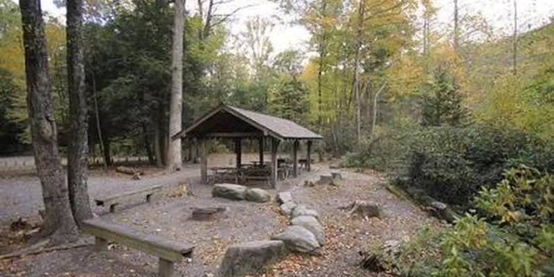
Briar Bottom Group Campground is the perfect getaway for visitors to enjoy mountain scenery and easy access to hiking trails. The campground sits at the base of Mt. Mitchell, the highest peak east of the Mississippi River, in Pisgah National Forest.
Recreation
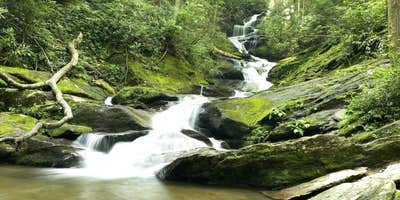
With the South Toe River located near the campground, visitors will have no shortage of things to do, including picnicking, day hiking, scenic driving and trout fishing. Hikers will be pleased with a variety of trails from which to choose, including a leisurely half-mile walk through the forest or a challenging 5.6-mile hike up Mt. Mitchell. The adjacent Black Mountain Campground has a playing field, volleyball courts and horseshoe pit available.
Facilities
The facility has six separate campsites; each can accommodate up to 30 people. Sites are organized around a single loop with individual parking spurs, providing plenty of space for tents. The campground is equipped with flush toilets and campers can use showers at the adjacent Black Mountain Campground. A campground host is available for visitor assistance.
Natural Features
The campground sits at an elevation of 3,040 feet. The 6,684-foot Mt. Mitchell towers over the area, with several other high peaks of the Black Mountains nearby. The lush forest in this part of the Appalachian Mountains is rich with wildlife, plants and scenery.
Nearby Attractions
Groups can easily head out for a day of scenic driving along Blue Ridge Parkway or hiking in Mount Mitchell State Park.
RV Road Trip Guides


Map & DirectionsBriar Bottom Group Campground is located in North Carolina near Montreat
Directions
From Asheville, North Carolina, take I-26 west to exit 9 onto 19 east toward Burnsville. Follow 19 to Micaville and turn right onto Highway 80. Continue south approximately 12-14 miles to Mount Mitchell Golf Course. Turn right on South Toe River Road and follow signs to Black Mountain Campground. Campers must enter through the main gate at Black Mountain Campground to get to Briar Bottom.
Address
50 BLACK MOUNTAIN CG ROAD
Burnsville, NC 28714
Coordinates
35.7527778 N
82.2213889 W
Connectivity
 T-MobileNo Coverage
- VerizonNo Coverage
- AT&TNo Coverage
Connectivity
- T-MobileNo Coverage
- VerizonNo Coverage
- AT&TNo Coverage
Access
- Drive-InPark next to your site
Site Types
- Tent Sites
- Group
Features
For Campers
- Market
- Trash
- Picnic Table
- Firewood Available
- Reservable
- Drinking Water
- Toilets
- Alcohol
- Pets
- Fires
Drive Time
- 1 hr 21 min from Asheville, NC
- 1 hr 37 min from Johnson City, TN
- 1 hr 53 min from Kingsport, TN


