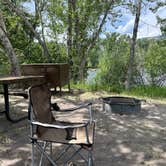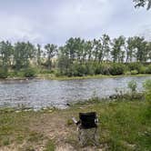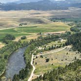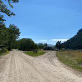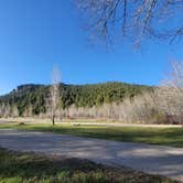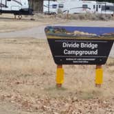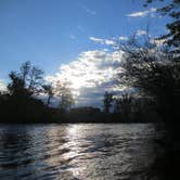

Where State Highway 43 crosses the Big Hole River, Divide Bridge Campground sits on Bureau of Land Management property with direct water access and a boat launch. The campground operates year-round at $10 per night, accepting cash or check payments with a 14-day stay limit.
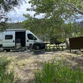
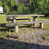
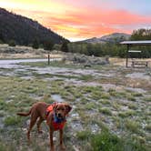
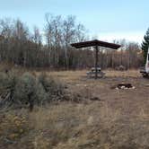
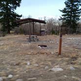
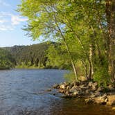
Two distinct camping loops offer different experiences. The upper loop provides level gravel sites with covered picnic tables, functioning more like a parking area with larger spaces that accommodate RVs up to the posted 24-foot limit. The lower loop places sites directly along the Big Hole River, offering shade from riverside vegetation but no table shelters. Linda notes that campers "came in dry and filled up with water," highlighting the reliable water source available on-site.
Clean vault toilets serve both loops, positioned centrally between the upper and lower areas. A camp host makes regular rounds throughout the day and maintains the grounds. The Sawmill Gulch Trailhead sits just before the campground entrance, providing hiking access up the mountainside. Cell service varies by location within the campground, with some areas receiving stronger signals than others.
Summer visitors should prepare for intense mosquito activity during July and August. The campground attracts primarily RV users, though tent camping works well in designated areas. For those exploring the broader region, campgrounds around Divide provide additional options within the Big Hole Valley.
Description
Divide Bridge Campground - 21 camping units with tables and fire-rings, boat ramp, restrooms, potable water, night lights, volunteer host and information kiosk.
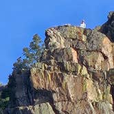
A series of small recreation sites are located along a 73-mile stretch of the Big Hole River between Wisdom and Melrose. The river offers blue ribbon trout fishing and excellent float boating. Nine of the sites are managed by BLM. Beginning at Melrose and going west, the sites are: Maiden Rock I, Maiden Rock East, Divide Bridge, Divide Campground, Jerry Creek Bridge, Dickie Bridge, East Bank, Sawlog Creek, and Pintlar Creek.
RV Road Trip Guides

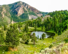
Map & DirectionsDivide Bridge Campground is located in Montana near Divide
 Public Campground
Directions
Take the Divide Exit from I-15, approximately 30 miles south of Butte. Sites are located both south and west of Divide. Sites west of Divide are located along Montana Highway 43.
Coordinates
45.75347158 N
112.7744134 W
Connectivity
 T-Mobile5GGood CoverageVerified by 2 usersLast on 6/8/26
 VerizonPossible CoverageVerified by 11 usersLast on 10/13/26
 AT&TNo Coverage
Connectivity
- T-Mobile5GGood CoverageVerified by 2 usersLast on 6/8/26
- VerizonPossible CoverageVerified by 11 usersLast on 10/13/26
- AT&TNo Coverage
Access
- Drive-InPark next to your site
- Walk-InPark in a lot, walk to your site.
- Boat-InSites accessible by watercraft.
Site Types
- Tent Sites
- RV Sites
- Standard (Tent/RV)
- Group
Features
For Campers
- ADA Access
- Picnic Table
- Phone Service
- Reservable
- Drinking Water
- Toilets
- Alcohol
- Pets
- Fires
For Vehicles
- Pull-Through Sites
- Big Rig Friendly
Drive Time
- 1 hr 17 min from Helena, MT
- 1 hr 31 min from Bozeman, MT
- 1 hr 48 min from Missoula, MT
- 2 hrs 29 min from Great Falls, MT