Accessible by a long, winding road, this US Forest Service group campground operates seasonally from late April through mid-September at $155 per reservation. The site sits within Trinity National Forest along Stoney Creek, providing direct access to the Trinity River for swimming and fishing activities. No RV hookups are available, and the forested setting means cell service is unavailable.
Campers report bear and wild boar activity in the area, making proper food storage essential. The Trinity River access allows for swimming and kayaking when water levels permit, though rapids can be intense during certain periods. For additional camping options, explore camping spots outside Weaverville. This group site works best for organized parties comfortable with remote conditions and wildlife encounters.
Description
Overview
Stoney Group Campground is nestled on the banks of Stoney Creek on the Stuart Fork Arm of Trinity Lake. This group camp can accommodate up to 60 people with tents. The sites are given some shade from tall trees, and two popular recreation areas on Trinity Lake are located nearby.
Recreation
The campground is adjacent to the popular Stoney Creek Swim Area, which offers a beach and picnic tables. A boat ramp and marina are located less than a mile away. Popular activities in the area include power and non-motorized boating, fishing and water skiing. Anglers can cast for catfish, as well as a variety of bass, trout and salmon.
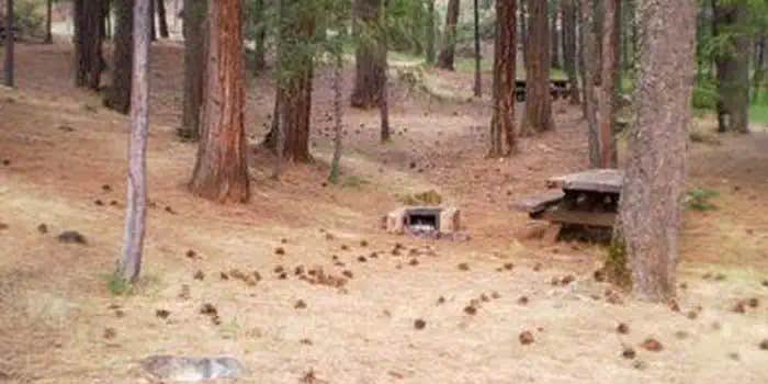
Facilities
There are flush toilets, drinking water, group pedestal grill, fire ring, several tables and bear-proof food lockers.
Natural Features
Trinity Lake sits at an elevation of 2,370 feet and is surrounded by the Trinity Alps. Black bears are frequently spotted in the area, as well as bobcats, mountain lions and a variety of bird species. Shasta-Trinity is the largest national forest in California with a diverse landscape encompassing five wilderness areas, hundreds of mountain lakes and 6,278 miles of streams and rivers.
Nearby Attractions
The nearby town of Weaverville is listed on the National Register of Historic Places. The former mining town offers restaurants, shopping and self-guided walking tours.
Fee Info
If the reservation was made through recreation.gov please call 1-877-444-6777 to make a refund request. Refunds must be requested no later than 14 days before your scheduled arrival date for a full refund (excluding recreation.gov fees). Reservation Fee: For some facilities, an additional reservation fee is charged. This additional non-refundable fee is $10.00 for the call center and online reservations. Refunds for Check or Cash Purchases: Refunds for cash payments will be issued a check refund. A refund will be processed within 30 days of receipt and approval. For cash or check refunds please call us at 530-275-8113. Please Note! Refund requests made during or after departure can only be processed when approved by the facility management staff based upon local policy. Refunds for Emergency Closures: In the event of an emergency closure the Recreation.gov will attempt to notify users and offer alternate dates and sites (as appropriate). If this is not possible, reservations will be canceled and all fees paid will be refunded. Refunds for Naturally Occurring Events: Refunds will not be issued for naturally occurring events like rain, snow, wind, smoke, extreme temperature, low lake level, etc. If you are requesting a refund for a walk-up site, please contact the host on-site or call us 530-275-8113. All refunds must be approved and issued through our office or processed though Recreation.gov.
RV Road Trip Guides


Map & DirectionsStoney Creek Group Campground is located in California near Weaverville
Directions
From I-5 in Redding, California, take 299 west to Weaverville. Go north on State Highway 3 for 14 miles. The campground is on the left.
Address
14538 Wonderland Blvd
Redding, CA 96019
Coordinates
40.8513889 N
122.8502778 W
Connectivity
 T-MobileNo Coverage
- VerizonNo CoverageVerified by 2 usersLast on 4/19/26
- AT&TNo Coverage
Connectivity
- T-MobileNo Coverage
- VerizonNo CoverageVerified by 2 usersLast on 4/19/26
- AT&TNo Coverage
Access
- Drive-InPark next to your site
Site Types
- Tent Sites
- RV Sites
- Standard (Tent/RV)
- Group
Features
For Campers
- Reservable
- Pets
Drive Time
- 1 hr 1 min from Redding, CA
- 1 hr 1 min from Redding, CA
- 3 hrs 49 min from Medford, OR
- 4 hrs 9 min from Medford, OR
