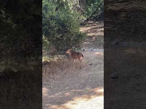
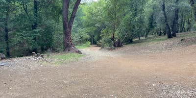
A winding dirt and gravel road climbs into the hills above Hopland before opening onto BLM Sheldon Creek, a free dispersed campground within the BLM Land — Ukiah Field Office managed lands of Mendocino County. The site sits near a freshwater creek and holds somewhere between two and five pullouts depending on conditions, with only a couple of spots featuring dedicated fire pits. Google Maps has led campers astray here, so following directions from The Dyrt or signage on the road itself is strongly advised.
The access road is the most discussed detail across reviews. High-clearance and 4WD vehicles handle it without much trouble, but tow-behinds and trailers are a different matter. The road gets narrow and offers no room to turn around once you're committed, and rain can leave the pullouts muddy. The creek runs through the area and adds a functional water element to the site, though at least one visitor found it difficult to reach directly.
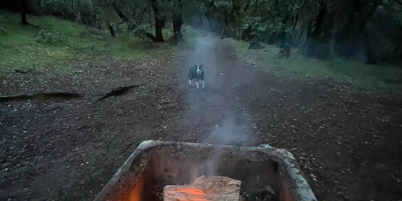
Amenities are minimal but present. There's a vault toilet on-site, along with picnic tables and fire rings at select spots. The toilet has drawn mixed reports, ranging from stocked with paper to heavily occupied by spiders, so campers may want to come prepared regardless. kenny T. noted "rough roads and can't turn back once on the path" for trailers, and also flagged that firewood is generally available in the surrounding area. Nearby, Buckhorn Campground provides another BLM option for those who want a fallback. This site works best for self-sufficient campers in trucks or SUVs who don't mind a remote approach and are comfortable with basic, no-frills facilities.
Description
Sheldon Creek is an isolated, primitive recreation site located 8 miles east of Hopland, south of Highway 175.
These 1700 acres of public land provide opportunities for camping, picnicking, hiking, hunting and equestrian use. Vehicle use is limited to the designated access road and OHVs are not permitted. The campground currently has three campsites and a vault toilet. There is no potable water at this site.
RV Road Trip Guides


Map & DirectionsBLM Sheldon Creek is located in California near Lakeport
Directions
From Hopland, take Hwy 175 east 3 miles. Turn right at the Old Toll Road (Younce Road) and drive 8 miles on a gravel road to the Sheldon Creek entrance. From Lake County: From Hwy 29 take Highland Springs Road South (County Road 412) 9.8 miles to Adobe Creek Road. Turn left and continue south 0.6 miles to Younce Road. Bear right and continue east of Old Toll Road (Younce Road) 1.6 miles to Sheldon Creek.
Coordinates
38.9619453 N
122.99156739999998 W
Connectivity
 T-MobileLTESome Coverage
 VerizonNo Coverage
- AT&TLTESome Coverage
Connectivity
- T-MobileLTESome Coverage
- VerizonNo Coverage
- AT&TLTESome Coverage
Access
- Drive-InPark next to your site
- Walk-InPark in a lot, walk to your site.
Site Types
- Dispersed
Features
For Campers
- Picnic Table
- Toilets
- Alcohol
- Pets
- Fires
For Vehicles
- Pull-Through Sites
DISPERSED CAMPING
Enjoy dispersed camping on government land and leave no trace. Pack in and pack out. No (or limited) services at this camping area. Permit may be required.
PERMIT might be REQUIRED
We curate permit requirements across the US for our PRO members. Try PRO to see if BLM Sheldon Creek needs a permit.
Drive Time
- 51 min from Santa Rosa, CA
- 1 hr 31 min from Vallejo, CA
- 1 hr 34 min from Napa, CA
- 2 hrs 12 min from Yuba City, CA