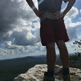
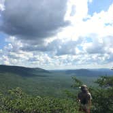
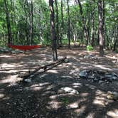
Reaching McDill Point requires a hike of roughly two miles from the Cheaha trailhead off Highway 281, a route that takes most groups between one and one and a half hours depending on pace. The trail climbs steadily, and navigation can be tricky in spots, so carrying the coordinates on a phone is worth the extra step. Along the way, campers pass debris from a 1972 plane crash, a landmark that confirms you are on the right path. Pets are welcome, and firewood is available on-site, supplemented by storm-downed wood scattered around the area.
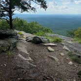
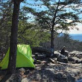
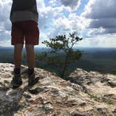
The camping area itself sits on a large, relatively flat section with multiple rock-built fire pits and enough tree coverage for several hammocks and tents. A second, much smaller site sits right at the cliff edge, with open sightlines toward the horizon that face west, making it well-suited to watching the sunset. That exposed position also means wind can pick up considerably overnight. Water is the main logistical concern: there are no reliable water sources at the site, and a small stream about a half mile further down the trail often runs dry. Carry in everything you need. For campers planning a longer stay in the region, campgrounds near Cheaha State Park give a sense of what else is accessible in the area.
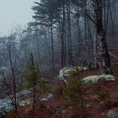
Several nearby backcountry options branch off the same trail system, including the Pinhoti Backpacking Site near McDill and the Cave Creek Trail Backcountry Campground a bit further out, both worth considering if McDill Point is already occupied. Cell service is listed as available, though conditions at elevation can vary. "Overnight, the clouds, fog and gentle misting rain rolled in, obscuring the view," notes Nancy C., a reminder that weather at the ridgeline shifts quickly and layers are worth packing regardless of the forecast. For a first backpacking trip or a short overnight with a payoff at the top, this site holds up.
Description
Start hiking at Cheaha Trailhead, located at the far end of a parking area just before you get to Cheaha State Park on Highway 281. Follow the Cave Creek Trail until you reach the Pinhoti connector, and hang a right to take the Pinhoti Trail northbound. Look for a sign that points to McDill overlook, and follow a side trail for the last quarter mile. Along this side trail you’ll pass the wreckage of a small plane that supposedly crashed back in 1972. Look for blue and white pieces of the plane off the trail to your right. Keep going and you’ll eventually come to a campsite that would comfortably fit 3 or 4 tents, only about 100 yards shy of the overlook. Camping in this area is a great option because you’re close to the cliffs, but protected from the wind. There are also a few spots right at the cliffs that are big enough for a small tent or hammocks and have better views, but are a bit breezier. The boulder cliffs are an awesome place to hang out at sunset or for stargazing, just remember to keep a headlamp on you! The next day, backtrack the quarter mile and continue on the Pinhoti back towards Cheaha State Park. Several rocky outcroppings provide some good views along the way.
RV Road Trip Guides

Map & DirectionsMcDill Point Backcountry is located in Alabama near Delta
 Public Campground
Coordinates
33.45461463 N
85.82150197 W
Connectivity
 T-Mobile5GExcellent Coverage
 VerizonLTESome Coverage
 AT&T5GGood CoverageVerified by 2 usersLast on 2/11/26
Connectivity
- T-Mobile5GExcellent Coverage
- VerizonLTESome Coverage
- AT&T5GGood CoverageVerified by 2 usersLast on 2/11/26
Access
- Walk-InPark in a lot, walk to your site.
- Hike-InBackcountry sites.
Site Types
- Tent Sites
- Group
Features
For Campers
- Firewood Available
- Phone Service
- Pets
- Fires
Drive Time
- 37 min from Anniston, AL
- 1 hr 3 min from Gadsden, AL
- 1 hr 20 min from Birmingham, AL
- 1 hr 34 min from Auburn, AL