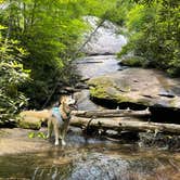
Nantahala National Forest's Panthertown Valley Backcountry Area draws backpackers into a network of dispersed campsites spread across multiple named trails, including Green Valley, Panthertown Valley, and Mac's Gap. There are no designated sites, no bathrooms, and no fee. Campers choose their own spots, which vary considerably in seclusion, proximity to water, and foot traffic depending on which trail corridor they follow.
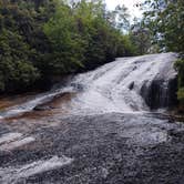
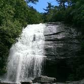
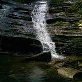
Water access is a consistent draw. Several sites sit close enough to creeks that filtering water is straightforward, though at least one spot near Tranquility Point requires campers to carry water from Schoolhouse Falls roughly 0.4 miles away. Waterfalls appear throughout the valley, and some sites near Granny Burrell Falls and Schoolhouse Falls see swimmers and day hikers in addition to overnight visitors. Bear activity is well-documented here. One camper reported a bear charging her group and destroying a tent, and multiple reviewers note that a bear canister is strongly recommended even when not formally required. Panthertown - Tranquility Point and Panthertown - Sheltor are nearby alternatives if you want a more defined camping spot.
Navigation requires preparation. The trail network includes many unofficial paths, and getting turned around is a real risk. Reviewers consistently recommend purchasing a dedicated Panthertown map, with the Friends of Panthertown website cited as a reliable source. "Bring a good map and stick to the trails that your map covers," notes Tony E. A cathole shovel and a method for packing out all waste are essential given the absence of facilities.
Description
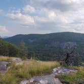
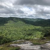
Panthertown Valley is a rugged and wild 6,311-acre backcountry area located on Nantahala National Forest in western North Carolina, on the eastern continental divide, between the Great Smoky Mountains and the Blue Ridge Mountains.
Panthertown features a diversity of native flora and fauna, pristine headwaters of the Tuckasegee River, a rare high-elevation southern Appalachian mountain bog, dozens of waterfalls, granite cliffs and domes, and is part of Blue Ridge National Heritage Area, and Bonas Defeat-Panthertown American Black Bear Sanctuary.
Friends of Panthertown works in partnership with the U.S. Forest Service to conserve this outstanding natural resource while improving the quality and experience of recreational opportunities in Panthertown.
Panthertown is a wonderful place to explore, however there are a few things you should be aware of before visiting for your first time. We hope this list of suggestions (and cautions) will make your experience in Panthertown Valley more enjoyable:
-
Your safety is your responsibility. Plan ahead and come prepared.
-
This is a wild, rugged place with more than 30 miles of public trails spread out over 6,311 acres deep in the Nantahala National Forest. It’s easy to get lost. We recommend you bring a good map and compass, and know how to use them.
-
Panthertown is NOT a National Park or State Park. It’s common to not see any other people when visiting. Cell phone service here can be spotty or unreachable. Use the trails with caution and at your own risk.
-
Bring plenty of water to drink, or a filtration system to keep you hydrated. There are no water fountains, trash cans, or restrooms here.
-
Please carry out your trash and practice Leave No Trace principles of outdoor ethics when visiting.
-
Hiking in the forest can be dangerous, especially for inexperienced hikers. Know before you go, plan ahead, and come prepared for a fun backcountry experience.
-
You may get hot, cold, wet, muddy, scratched up, and dirty just from hiking and exploring in Panthertown, so dress appropriately and in layers.
-
Expect to hike several miles on uneven surfaces to reach the most popular points of interest, including waterfalls and overlooks.
-
The hike out of the valley is uphill and can be difficult. Some hiking experience is recommended. Make sure you save some energy and water for your walk back to the parking area. That’s all part of the Panthertown experience!
-
American black bears live here and are protected as part of the Bonas Defeat-Panthertown Bear Sanctuary. Panthertown hosts a diversity of wildlife, please do not feed the animals!
-
Common natural hazards to watch out for include venomous snakes and yellow jacket nests.
-
Friends of Panthertown volunteers only maintain the official trail system in Panthertown. There are hundreds of miles of user created footpaths that crisscross the valley. For your safety, and to protect the ecology, we recommend you stay on the marked trails and avoid short cuts through the woods. Remember, it’s easy to get lost here, and we want you to enjoy your backcountry experience.
CAMPING
-
Dispersed camping is primitive and no amenities are provided. Forest Service rules limit camp sites to no more than 12 people, and not within 50 feet of water sources. No permits are required for non-commercial groups.
-
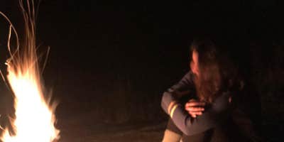
Please use existing fire rings and never leave a fire unattended. Make sure to properly extinguish and drown your fire and coals before leaving your camp site!
-
Follow these recommendations to avoid any close encounters with bears: https://panthertown.org/bears/
PARKING
-
There is limited parking at three entrances (Salt Rock Gap, Cold Mountain Gap, and Flat Creek), low-clearance gravel Forest Service roads, and heavy use on weekends. https://panthertown.org/directions
-
Drive slowly and use caution to not damage your vehicle or the road.
-
Equestrians please note: there are no horse trails at the Cold Mountain Gap trailheads. Horse trailer parking is prohibited there. The Salt Rock Gap entrance offers limited parking and can be difficult to turn a horse trailer around. If you use this entrance, we suggest that you park and unload your trailer on the pavement at the end of state maintained Breedlove Road.
-
The Flat Creek parking area off Rock Bridge Road north of Lake Toxaway on NC 281 is the largest and offers a wide horse trailer turn around with easy access to the Panthertown Valley Trail System.
LEAVE NO TRACE
Always practice Leave No Trace principles of outdoor ethics when visiting.
The Seven Principles of Leave No Trace:
-
Plan Ahead and Prepare
-
Travel and Camp on Durable Surfaces
-
Dispose of Waste Properly
-
Leave What You Find
-
Minimize Campfire Impacts
-
Respect Wildlife
-
Be Considerate of Other Visitors
Reprinted with permission ©Leave No Trace
RV Road Trip Guides


Map & DirectionsPanthertown Valley Backcountry Area is located in North Carolina near Sapphire
 Public Campground
Coordinates
35.17189398 N
83.01690567 W
Connectivity
 T-Mobile5GExcellent Coverage
 VerizonLTESome Coverage
- AT&TLTESome Coverage
Connectivity
- T-Mobile5GExcellent Coverage
- VerizonLTESome Coverage
- AT&TLTESome Coverage
Access
- Walk-InPark in a lot, walk to your site.
- Hike-InBackcountry sites.
Site Types
- Group
- Equestrian
Features
For Campers
- Firewood Available
- Phone Service
- Pets
- Fires
FREE established camping
Enjoy camping on government land. Limited or no services at this camping area.
PERMIT might be REQUIRED
We curate permit requirements across the US for our PRO members. Try PRO to see if Panthertown Valley Backcountry Area needs a permit.
Drive Time
- 1 hr 31 min from Asheville, NC
- 1 hr 55 min from Greenville, SC
- 2 hrs 11 min from Spartanburg, SC