Public Campground
Paddy's Creek — Lake James State Park
Warning 2 Alerts are In Effect
There are 2 alerts for this campground. Camp safely!
Warning 2 Alerts are In Effect
There are 2 alerts for this campground. Camp safely!
**The Long Arm Boat-in sites require boats to access**
Holiday booking date rules are as follows: 2 nights Minimum Stay on holiday weekend (Friday/Saturday or Saturday/Sunday) 2 nights Minimum Stay still apply to cabin rentals at Hanging Rock and Morrow Mountain State Parks 1 night Minimum Stay on holiday weekend if the booking dates within 14 Days before Arrival Date Rule applies to the following holiday weekends: Memorial Day July 4th Labor Day
Paddy's Creek at Lake James State Park is surrounded by forested terrain and the waters of Lake James. Temperatures range from 30°F in winter to 85°F in summer. Nearby, visitors can explore the Linville Gorge Wilderness Area and the historic town of Morganton.
Description
The Paddy's Creek access has 33 drive-in sites that are perfect with families with lots of camping gear. These sites are open to a maximum of 6 people per campsite.
Each campsite has parking for two vehicles adjacent to the camping pad. Each site's driveway is 20 feet long.
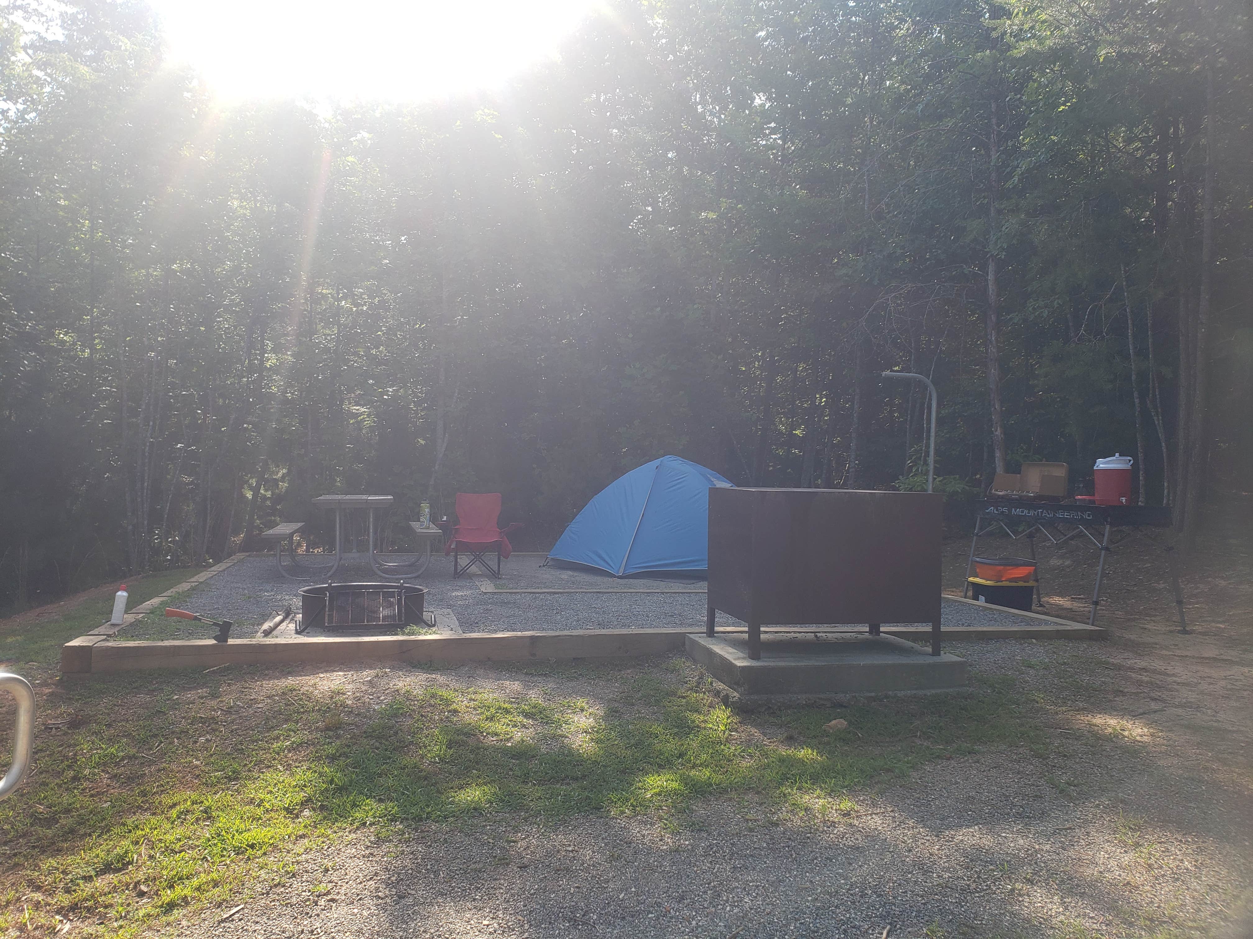
The campsite has a fire pit and picnic table. The tent pad measures 12 feet by 12 feet.
Potable faucets are located throughout the camping area. There is a centrally located bathhouse with toilets and hot showers that is open 24/7.
Sites 13 and 14 are accessible for people with limited mobility or disabilities. Please do not reserve an accessible site if no one in your group needs it, unless it is the only site left available when you are making your reservation.
Reservation Info
Park gates are closed and locked at posted closing times for your protection. All visitors who are not spending the night need to be out by closing time. Vehicles left overnight must have a camping tag.
The electronic gates at Paddy's Creek access open automatically when a vehicle exiting the park slowly approaches the gate. Campers may enter the parking areas after hours with the electronic code printed on the reservation confirmation or receipt.
Location
Paddy's Creek — Lake James State Park is located in North Carolina
Directions
Lake James State Park is located in Burke and McDowell counties, five miles northeast of Marion on NC 126. To get to the Paddy's Creek Area of Lake James State Park: - Traveling east on I-40: From I-40, take the Nebo/Lake James exit (exit 90) and head north. After a half mile, turn right onto Harmony Grove Road, and follow it for 2 miles to a stoplight. Proceed straight across the intersection and past Nebo Elementary School to a stop sign. Turn right onto NC 126, and follow the signs to the park entrance 4.8 miles on the right. - Traveling west on I-40: From I-40, take the Dysartsville/Lake James exit (exit 94) and head north for 0.5 mile to a stop sign. Turn left onto US 70 and follow it for 1.5 miles. Turn right onto Bridgewater Road and travel 1.2 miles. Turn left onto Benfield's Landing Road, and follow it for 2 miles to a stop sign. Turn right onto NC 126, and follow the signs to the park entrance 0.7 miles on the right. To get to the Catawba River Area of Lake James State Park: - Traveling east on I-40: From I-40, take the Nebo/Lake James exit (exit 90) and head north. After a half mile, turn right onto Harmony Grove Road, and follow it for 2 miles to a stoplight. Proceed straight across the intersection and past Nebo Elementary School to a stop sign. Turn right onto NC 126, and follow the signs to the park entrance 2.3 miles on the left. - Traveling west on I-40: From I-40, take the Dysartsville/Lake James exit (exit 94) and head north for 0.5 miles to a stop sign. Turn left onto US 70 and follow it for 1.5 miles. Turn right onto Bridgewater Road and travel 1.2 miles. Turn left onto Benfield's Landing Road, and follow it for 2 miles to a stop sign. Turn left onto NC 126, and follow the signs to the park entrance 1.7 miles on the right. To get to the Long Arm Boat-in Campground at Lake James State Park: - The Long Arm Boat-in Campground is only accessible by boats, not vehicles. - By power boat: Launch from the Canal Bridge Public Boat Ramp located 1.7 miles southwest of the Paddy’s Creek Area entrance on NC 126. Overnight parking is free and does not require a permit. (Overnight parking is not permitted at the Hidden Cove Public Boat Ramp.) - By canoe or kayak: Launch from the Paddy’s Creek Day-use Area, located at the end of Lake James State Park Road. Obtain a free overnight parking pass for the vehicle’s dashboard, park in the top tier of the lot, and paddle to the campsite. Campers can also launch from the Canal Bridge Public Boat Ramp located 1.7 miles southwest of the Paddy’s Creek Area entrance on NC 126.
Address
PO Box 340
Nebo, NC 28761
Coordinates
35.757110937835826 N
81.87505168171867 W
Connectivity
- T-MobileLTESome Coverage
- VerizonLTESome CoverageVerified by 7 usersLast on 2/1/26
- AT&TLTESome Coverage
Connectivity
- T-MobileLTESome Coverage
- VerizonLTESome CoverageVerified by 7 usersLast on 2/1/26
- AT&TLTESome Coverage
Access
- Drive-InPark next to your site
- Boat-InSites accessible by watercraft.
Site Types
- Tent Sites
- RV Sites
- Standard (Tent/RV)
- Group
Features
For Campers
- Picnic Table
- Firewood Available
- Reservable
- Showers
- Electric Hookups
- Toilets
- Pets
- Fires
For Vehicles
- Sewer Hookups
- Water Hookups
- 30 Amp Hookups
- 50 Amp Hookups
Contact
General Info
Reservations
Drive Time
- 52 min from Asheville, NC
- 1 hr 29 min from Spartanburg, SC
- 1 hr 41 min from Johnson City, TN


