Campground photo 1
Campground photo 2
Campground photo 3

Top Tent Camping near Blanding, UT

Looking for the best tent campgrounds near Blanding? Find the best tent camping sites near Blanding. Would you prefer a quiet dispersed site or an established camgpround with amenities? Either way, The Dyrt makes it easy to find the perfect place to pitch your tent.

Best Tent Camping Sites Near Blanding, UT (65)

    Camper-submitted photo from Devils Canyon Campground
    Camper-submitted photo from Devils Canyon Campground
    Camper-submitted photo from Devils Canyon Campground
    Camper-submitted photo from Devils Canyon Campground
    Camper-submitted photo from Devils Canyon Campground
    Camper-submitted photo from Devils Canyon Campground

    1.

    Devils Canyon Campground

    17 Reviews
    30 Photos
    118 Saves
    Blanding, Utah

    Overview

    Devils Canyon Campground sits in the Manti-LaSal National Forest of southeast Utah at the foot of the Abajo Mountains. There is water available seasonally from June to September.

    Recreation

    Several miles of off-road vehicle trails crisscross the Abajo Mountains. The Camp Jackson/Wagon Wheel Trail can be accessed nearby. The Abajo Loop State Scenic Backway passes by the campground. It leads from the desert floor and red rock canyons to steep mountains over 10,000 feet high, with overlooks and panoramic views. The byway is suitable for passenger vehicles from late spring through fall but is not recommended for large RVs.

    Facilities

    Several miles of off-road vehicle trails crisscross the Abajo Mountains. The Camp Jackson/Wagon Wheel Trail can be accessed nearby. The Abajo Loop State Scenic Backway passes by the campground. It leads from the desert floor and red rock canyons to steep mountains over 10,000 feet high, with overlooks and panoramic views. The byway is suitable for passenger vehicles from late spring through fall but is not recommended for large RVs.

    Natural Features

    Ponderosa pines, pinyon pines and juniper cover the area, offering limited shade. The campground sits at an elevation of 7,400 feet, and summer temperatures are warm in the day and cool in the evening. Birds, squirrels, chipmunks, mule deer and black bear may be seen in the area.

    Nearby Attractions

    Popular attractions in the area include Canyonlands, Arches and Mesa Verde National Parks, Dark Canyon Wilderness, Edge of the Cedars State Park, Lake Powell and numerous archaeological sites. Evening programs are provided at Edge of the Cedars Museum in Blanding. The San Juan County Fair is held annually in August in Monticello.

    • Pets
    • Fires
    • Phone Service
    • RVs
    • Tents
    • Group

    $20 / night

    Camper-submitted photo from BLM Sand Island Campground
    Camper-submitted photo from BLM Sand Island Campground
    Camper-submitted photo from BLM Sand Island Campground
    Camper-submitted photo from BLM Sand Island Campground
    Camper-submitted photo from BLM Sand Island Campground
    Camper-submitted photo from BLM Sand Island Campground

    2.

    BLM Sand Island Campground

    18 Reviews
    78 Photos
    163 Saves
    Bluff, Utah

    Sand Island campground and recreation Area is located on the north bank of the San Juan River about 3 miles west of Bluff, Utah, on the south side of Highway 191. The 27-site campground is open year round. Campground facilities include drinking water (seasonal, March through October), vault toilets, picnic tables, fire rings, a day use picnic area, and a boat launch for the San Juan River (permits required). Regular campsites can't be reserved in advance and are "first come, first served" and self-register at the campground. Sites are $15 per night. There is a two car maximum per site. Two group sites for large groups are available to reserve in advance on this site. Search for "Sand Island Group Sites" for more information and to make a reservation.

    • Pets
    • Fires
    • Phone Service
    • ADA Access
    • RVs
    • Tents

    $8 - $15 / night

    Camper-submitted photo from Natural Bridges Campground
    Camper-submitted photo from Natural Bridges Campground
    Camper-submitted photo from Natural Bridges Campground
    Camper-submitted photo from Natural Bridges Campground
    Camper-submitted photo from Natural Bridges Campground
    Camper-submitted photo from Natural Bridges Campground

    3.

    Natural Bridges Campground

    14 Reviews
    21 Photos
    292 Saves
    Blanding, Utah

    Overview

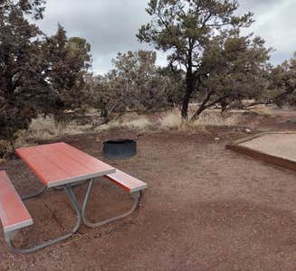
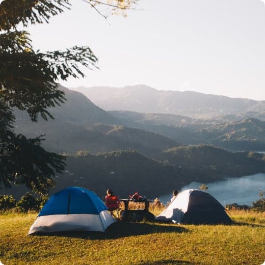
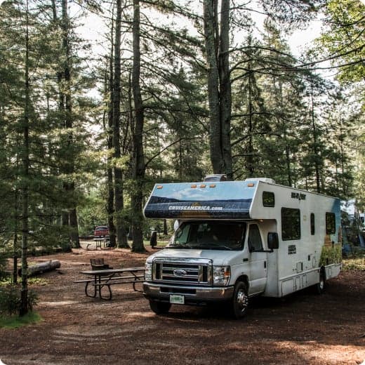
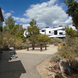
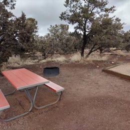
    The campground includes 13 sites total, each of which can accommodate tent campers or RVs. Due to the size of the campground, there is a length limit of 26 feet combined. The campground is open year-round and is typically busiest from mid-March to mid-June. Visitation also spikes in the late fall, between September and October. The campground tends to fill up quickly during these busy periods.__ The Natural Bridges National Monument Campground is located approximately 35 miles West of Blanding, UT, nestled in the heart of Bears Ears National Monument. Situated in a high-desert environment at 6,500 feet above sea level, the campground is surrounded by a sprawling pinon-juniper forest. The elevation can also be cause for dramatic temperature fluctuations. Temperatures can reach highs of 100 degrees Fahrenheit mid-Summer and can dip below freezing in the Winter.____

    Recreation

    Natural Bridges National Monument is home to three of the largest natural bridges in the United States. The bridges can be viewed from three overlooks situated along the nine-mile loop drive through the park. The overlooks are each paved and located less than one-quarter mile from the parking areas. Hiking trails to the bridges themselves are also available. Descend into White or Armstrong canyons and wind along the wash to view the bridges from below. The hiking routes along the canyon bottom are unmaintained and may experience small changes depending on weather.__ Visitors may also encounter archeological sites in the area. When visiting archeological sites, structures, pictographs, petroglyphs, or delicate rock formations, please visit with respect. Stop by the visitor center and ask a ranger about the "Dos and Don'ts" of visiting these areas. Natural Bridges also boasts an incredible night sky as the world___s first International Dark Sky Park. Night-sky programming may be available in the spring and fall, dependent on staffing levels.____

    Facilities

    Natural Bridges National Monument is home to three of the largest natural bridges in the United States. The bridges can be viewed from three overlooks situated along the nine-mile loop drive through the park. The overlooks are each paved and located less than one-quarter mile from the parking areas. Hiking trails to the bridges themselves are also available. Descend into White or Armstrong canyons and wind along the wash to view the bridges from below. The hiking routes along the canyon bottom are unmaintained and may experience small changes depending on weather.__ Visitors may also encounter archeological sites in the area. When visiting archeological sites, structures, pictographs, petroglyphs, or delicate rock formations, please visit with respect. Stop by the visitor center and ask a ranger about the "Dos and Don'ts" of visiting these areas. Natural Bridges also boasts an incredible night sky as the world___s first International Dark Sky Park. Night-sky programming may be available in the spring and fall, dependent on staffing levels.____

    Natural Features

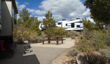
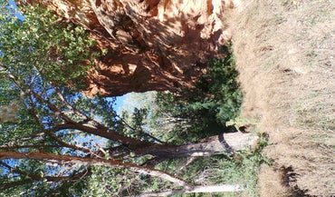
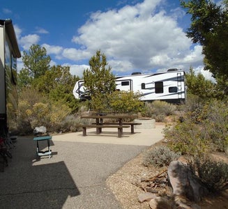
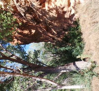
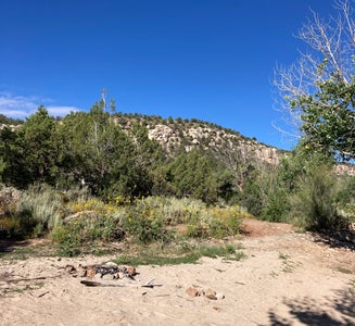
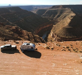
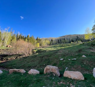
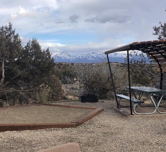
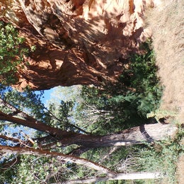
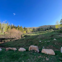
    The Natural Bridges National Monument Campground is located just one-quarter mile from the Visitor Center, which can be accessed by car, bike, or by walking path. Visitors can connect the trail to the Visitor Center with another short path that leads to the park___s solar field, which provides all power for the monument. Please stay on the marked pathways and campsites, as an abundance of living biological soil crust surrounds the campground. Views of the Bears Ears, a natural formation of two buttes for which the surrounding area is named, can be seen from the campground. The campground is enclosed by beautiful pinon pine and juniper forest, which provides ample privacy between sites without obstructing the view of wide-open skies. These vast and unpolluted skies make Natural Bridges a wonderful place to stargaze.__

    Nearby Attractions

    Natural Bridges National Monument is surrounded by a multitude of public Federal Lands, including the Bureau of Land Management (BLM), National Forest Service (NFS), and other National Park Service (NPS) sites, as well as state and tribal parks. Within a two-hour drive or less, visitors can access Bears Ears National Monument, Hovenweep National Monument, various NFS recreation areas, Goosenecks State Park, Monument Valley Tribal Park, and Arches and Canyonlands National Parks. All of these locations have opportunities for hiking, scenic viewing, and other activities. There are also several museums in the area, including Edge of the Cedars State Park in Blanding, UT and Canyons of the Ancients National Monument in Delores, CO.__

    • Pets
    • Fires
    • RVs
    • Tents
    • Group
    • Standard (Tent/RV)

    $16 / night

    Camper-submitted photo from Manti-LaSal National Forest Nizhoni Campground
    Camper-submitted photo from Manti-LaSal National Forest Nizhoni Campground
    Camper-submitted photo from Manti-LaSal National Forest Nizhoni Campground
    Camper-submitted photo from Manti-LaSal National Forest Nizhoni Campground
    Camper-submitted photo from Manti-LaSal National Forest Nizhoni Campground
    Camper-submitted photo from Manti-LaSal National Forest Nizhoni Campground

    4.

    Manti-LaSal National Forest Nizhoni Campground

    5 Reviews
    13 Photos
    5 Saves
    Blanding, Utah

    Overview

    Nizhoni Campground sits in the Manti-LaSal National Forest in southeast Utah, at the foot of the Abajo Mountains.__

    Recreation

    Popular activities include hiking, wildlife viewing and off-road vehicle riding. Several trailheads are nearby, including Shay Ridge, Aspen Flat and Red Ledges. The Abajo Loop State Scenic Backway passes by the campground. It leads from the desert floor and red rock canyons to steep mountains over 10,000 feet high, with overlooks and panoramic views. The byway is suitable for passenger vehicles from late spring through fall but is not recommended for large RVs.

    Facilities

    Popular activities include hiking, wildlife viewing and off-road vehicle riding. Several trailheads are nearby, including Shay Ridge, Aspen Flat and Red Ledges. The Abajo Loop State Scenic Backway passes by the campground. It leads from the desert floor and red rock canyons to steep mountains over 10,000 feet high, with overlooks and panoramic views. The byway is suitable for passenger vehicles from late spring through fall but is not recommended for large RVs.

    Natural Features

    Towering Ponderosa pines forest the site, offering partial shade. Gambel oaks and sagebrush dot the landscape. The campground sits at an elevation of 7,000 feet, and summer temperatures range from 80-90 degrees during the day and 55-65 degrees at night. Mule deer, wild turkeys, Abert's squirrels and the occasional black bear may be seen in the area.

    Nearby Attractions

    Other attractions in the area include Canyonlands, Arches and Mesa Verde National Parks, Dark Canyon Wilderness, Edge of the Cedars State Park, Lake Powell and numerous archaeological sites.

    • Pets
    • Fires
    • RVs
    • Tents
    • Group
    • Standard (Tent/RV)

    $50 / night

    Camper-submitted photo from Goosenecks State Park Campground
    Camper-submitted photo from Goosenecks State Park Campground
    Camper-submitted photo from Goosenecks State Park Campground
    Camper-submitted photo from Goosenecks State Park Campground
    Camper-submitted photo from Goosenecks State Park Campground
    Camper-submitted photo from Goosenecks State Park Campground
    Camper-submitted photo from CR 0083
    Camper-submitted photo from CR 0083
    Camper-submitted photo from CR 0083
    Camper-submitted photo from CR 0083
    Camper-submitted photo from CR 0083
    Camper-submitted photo from CR 0083

    6.

    CR 0083

    6 Reviews
    16 Photos
    172 Saves
    Monticello, Utah
    • Pets
    • Fires
    • Phone Service
    • RVs
    • Tents
    • Group
    Camper-submitted photo from Old West RV Park - Utah
    Camper-submitted photo from Old West RV Park - Utah
    Camper-submitted photo from Old West RV Park - Utah
    Camper-submitted photo from Old West RV Park - Utah
    Camper-submitted photo from Old West RV Park - Utah
    Camper-submitted photo from Old West RV Park - Utah

    7.

    Old West RV Park - Utah

    5 Reviews
    6 Photos
    11 Saves
    Monticello, Utah

    Welcome to Old West RV Park! We take pride in welcoming our campers with a warm and friendly atmosphere to make them feel as their home away from home. This is an intimate and well kept RV park. We offer well level pull-through and back-in RV sites and cabins. We have laundry facilities, a bathhouse and community restrooms.

    The campground is conveniently located right in town and close to Arches National Park. Easy access from the highway.

    • Pets
    • Fires
    • Electric Hookups
    • Phone Service
    • Reservable
    • RVs

    $45 - $80 / night

    Camper-submitted photo from Hovenweep National Monument
    Camper-submitted photo from Hovenweep National Monument
    Camper-submitted photo from Hovenweep National Monument
    Camper-submitted photo from Hovenweep National Monument
    Camper-submitted photo from Hovenweep National Monument
    Camper-submitted photo from Hovenweep National Monument

    8.

    Hovenweep National Monument

    10 Reviews
    14 Photos
    112 Saves
    Montezuma Creek, Utah

    Overview

    Hovenweep Campground is nestled within the beautiful, sweeping landscape of the Colorado Plateau in Southeast Utah, at an elevation of approximately 5300 ft. The campground is located alongside two converging canyons and is only 1/4 mile (.4km) from the park's visitor center. Stunning views of mountains, canyons, and sandstone ledges adorned with desert plants make for a spectacular camping experience!

    Recreation

    Hovenweep offers multiple hikes, with the most popular being the Square Tower Group's 2-mile (3.2km) walking loop. This hike has the densest population of ancestral Puebloan structures within Hovenweep and allows visitors to get within 5-10 feet of them, creating an intimate and humbling experience with fantastic opportunities for photography. For visitors seeking a longer hike, the Holly Trail is conveniently located at the back of the campground and is roughly 8 miles (12.9 km) round-trip, traversing through 2 slot canyons within Keely Canyon and leading visitors to Hovenweep's outlying site, Holly. Additional hikes to Hovenweep's remaining outlying sites are also available, but generally require a higher-clearance vehicle to access and are subject to variable road conditions. Visitors can also enjoy the majesty and vastness of the dark skies and glowing stars here at our certified International Dark Sky Park!

    Facilities

    Hovenweep offers multiple hikes, with the most popular being the Square Tower Group's 2-mile (3.2km) walking loop. This hike has the densest population of ancestral Puebloan structures within Hovenweep and allows visitors to get within 5-10 feet of them, creating an intimate and humbling experience with fantastic opportunities for photography. For visitors seeking a longer hike, the Holly Trail is conveniently located at the back of the campground and is roughly 8 miles (12.9 km) round-trip, traversing through 2 slot canyons within Keely Canyon and leading visitors to Hovenweep's outlying site, Holly. Additional hikes to Hovenweep's remaining outlying sites are also available, but generally require a higher-clearance vehicle to access and are subject to variable road conditions. Visitors can also enjoy the majesty and vastness of the dark skies and glowing stars here at our certified International Dark Sky Park!

    Natural Features

    The campground is forested with beautiful, established Utah Juniper trees along with many desert wildflowers and plants, dotting the landscape and offering vivid color to the surrounding sandstone ledges and canyons. Spring reveals the majesty of Veined Penstemon, painting our park with pinks, blues and purples, while Fall sparkles with yellow rabbit brush accents. The park is within an arid, high desert environment with hot summers and cold winters. Hovenweep is home to many species of wildlife, ranging from antelope ground squirrels, ravens, and songbirds to coyotes, jack rabbits and lizards. Many nights and mornings are filled with the calls and songs of our local wildlife! This area piques the interest of many wildlife viewers, birders, and artists as they pull inspiration from the natural beauty and welcoming peace of Hovenweep!

    Nearby Attractions

    Hovenweep is located roughly 45 miles from the nearest town with restaurants and shopping. The closest gas station is located 20 miles from the park, in Aneth, Utah. Our park is located next to Canyons of the Ancients National Monument, which is managed by the Bureau of Land Management. Canyons of the Ancients offers mountain biking/horseback riding trails, as well as archaeological sites and other areas of interest for visitors to explore. There are also multiple state, national, and tribal parks located within an hour or two's driving distance from Hovenweep.

    • Pets
    • Fires
    • Phone Service
    • RVs
    • Tents
    • Standard (Tent/RV)

    $20 / night

    Camper-submitted photo from Manti-LaSal National Forest Buckboard Campground
    Camper-submitted photo from Manti-LaSal National Forest Buckboard Campground
    Camper-submitted photo from Manti-LaSal National Forest Buckboard Campground
    Camper-submitted photo from Manti-LaSal National Forest Buckboard Campground
    Camper-submitted photo from Manti-LaSal National Forest Buckboard Campground
    Camper-submitted photo from Manti-LaSal National Forest Buckboard Campground

    9.

    Manti-LaSal National Forest Buckboard Campground

    5 Reviews
    18 Photos
    3 Saves
    Monticello, Utah

    Overview

    Buckboard Campground sits in the Manti-LaSal National Forest in southeast Utah at the foot of the Abajo Mountains. Visitors enjoy fishing and exploring local trails.

    Recreation

    Popular activities include fishing, hiking and off-road vehicle riding. Several trailheads are nearby, including Robertson's Pasture Trail and Spring Creek Trail. The Abajo Loop State Scenic Backway passes by the campground. It leads from the desert floor and red rock canyons to steep mountains over 10,000 feet high, with overlooks and panoramic views. The byway is suitable for passenger vehicles from late spring through fall but is not recommended for large RVs.

    Facilities

    Popular activities include fishing, hiking and off-road vehicle riding. Several trailheads are nearby, including Robertson's Pasture Trail and Spring Creek Trail. The Abajo Loop State Scenic Backway passes by the campground. It leads from the desert floor and red rock canyons to steep mountains over 10,000 feet high, with overlooks and panoramic views. The byway is suitable for passenger vehicles from late spring through fall but is not recommended for large RVs.

    Natural Features

    Aspens and Gambel oaks surround the site, offering partial shade. The campground sits at an elevation of 8,900 feet, and summer temperatures range from 75-85 degrees during the day and 50-60 degrees at night. Mule deer, wild turkeys and black bears frequent the area.

    Nearby Attractions

    Other attractions in the area include Canyonlands, Arches and Mesa Verde National Parks, Natural Bridges National Monument, Dark Canyon Wilderness, Edge of the Cedars State Park, Lake Powell and numerous archaeological sites.

    • Pets
    • Fires
    • RVs
    • Tents
    • Group
    • Picnic Table

    $50 / night

    Camper-submitted photo from Hamburger Rock Campground
    Camper-submitted photo from Hamburger Rock Campground
    Camper-submitted photo from Hamburger Rock Campground
    Camper-submitted photo from Hamburger Rock Campground
    Camper-submitted photo from Hamburger Rock Campground
    Camper-submitted photo from Hamburger Rock Campground

    10.

    Hamburger Rock Campground

    19 Reviews
    96 Photos
    241 Saves
    La Sal, Utah

    Overview

    Hamburger Rock Campground is a good option for visitors wishing to recreate in the Indian Creek area of Bears Ears National Monument or be close to the Needles District of Canyonlands National Park. The campground is located north off the Needles Highway (accessed from Utah State Route 211), approximately 3 miles southeast of Canyonlands National Park and 17 miles northwest of Newspaper Rock. The campground provides 10 campsites that each feature a tent/trailer space, a picnic table, a fire ring, and vault toilets. Each campsite can hold 10 people and 2 vehicles. There is no drinking water at the campground. Reservations are not available for camping at this location. Campsites are available on a first come, first served basis upon arrival at the self-register kiosk at the site. The Indian Creek area is generally primitive and undeveloped, with few services.__

    Recreation

    The Indian Creek area of Bears Ears National Monument has gained international recognition for its extraordinary natural beauty and recreational opportunities. The Indian Creek canyon opens to a broad valley rimmed by Wingate Sandstone cliffs known for world-class rock climbing. Prominent geologic features include Lavender Mesa, Bridger Jack Mesa, and North and South Six Shooter Peaks. This spectacular setting and rich archeological resources provide visitors with recreational opportunities such as rock climbing, camping, cultural resource viewing, scenic photography, and off-highway vehicle (OHV) touring on designated routes.

    Facilities

    The Indian Creek area of Bears Ears National Monument has gained international recognition for its extraordinary natural beauty and recreational opportunities. The Indian Creek canyon opens to a broad valley rimmed by Wingate Sandstone cliffs known for world-class rock climbing. Prominent geologic features include Lavender Mesa, Bridger Jack Mesa, and North and South Six Shooter Peaks. This spectacular setting and rich archeological resources provide visitors with recreational opportunities such as rock climbing, camping, cultural resource viewing, scenic photography, and off-highway vehicle (OHV) touring on designated routes.

    Natural Features

    The campsites are situated at the base of the Hamburger Rock geologic feature, a red sandstone monolith. A few of the sites are shaded by small juniper trees, but most are shaded only by the rock itself.

    contact_info

    For facility specific information, please call (435) 587-1500.

    Nearby Attractions

    Newspaper Rock Needles District of Canyonlands National Park

    Charges & Cancellations

    No refunds are available.

    • Pets
    • Fires
    • RVs
    • Tents
    • Standard (Tent/RV)
    • Toilets

    $15 / night

Showing results 1-10 of 65 campgrounds

Popular Camping Styles near Blanding

Pet-friendly camping near Blanding

Recent Tent Reviews In Blanding

288 Reviews of 65 Blanding Campgrounds


No Reviews Found