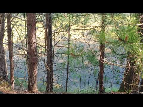
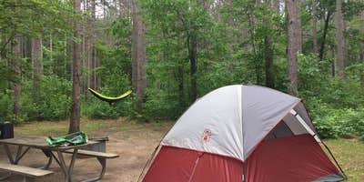
Hikers and paddlers use Seaton Creek Campground as a launching point for exploring the Manistee River Trail and accessing Michigan's second-largest suspension bridge. The campground sits within the Manistee National Forest, where pine trees provide natural shade across spacious, well-separated sites that accommodate groups up to 25 people.
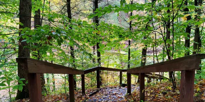
The Manistee River flows nearby, offering fishing opportunities and water access for canoes and kayaks. A one-mile trail connects campers to the main Manistee River Trail system, while the suspension bridge provides access to the North Country Trail on the opposite bank. Art S. notes the campground "is near the start of the Manistee River Trail" with "day hiker parking right in the camp."
Sites feature picnic tables and fire rings, with vault toilets and hand-pump water available throughout the campground. The camp host sells firewood on-site. Cell service reaches one bar, sufficient for emergency calls but limited for regular use. Narrow dirt roads lead to individual sites, and some campers report navigation challenges without an entrance map.
The campground operates from mid-May through mid-September, with reservations available through the Forest Service. For those planning extended stays in the region, campgrounds just outside Mesick provide additional options within a short drive of the forest.
Description
Overview
Seaton Creek Campground adjoins Seaton Creek and is at the upper end of the backwater of Hodenpyl Dam Pond on the Big Manistee River. The forest surrounding the campground is mostly pine and the sites are rustic. The closest town is Mesick.
Recreation
The surrounding waters offer excellent fishing opportunities for both panfish (perch, bluegil, crappie, sunfish) and game fish (trout, bass, pike, salmon). For State Fishing Regulations consult the Michigan Department of Natural Resources website, website http://www.michigan.gov/dnr/ . Kayakers may access the campground by traveling up the very shallow Seaton Creek, however canoeing is not recommended unless you're putting in at the Hodenpyl Backwaters. From there, you can canoe the Big Manistee. There is a connector trail to the Manistee River Trail from this site. The North Country National Scenic Trail can be reached by crossing the suspension bridge over the Manistee River. The Upper Branch Trailhead is also nearby.
Facilities
Two group sites and 17 family sites area situated near a picnic area on the Hodenpyl Backwater of the Manistee River. There are two vault restroom buildings. Sites have fire rings and picnic tables. Drinking water is available.
Natural Features
The terrain surrounding Hodenpyl Dam Pond is characterized as hilly with a mix of hardwoods and conifers. Briar Hill, which has the second-highest elevation in the lower peninsula, is located about five miles east of Hodenpyl Dam Pond. A number of other tributaries enter Hodenpyl Dam Pond from the east, flowing off the slopes of Briar Hill. These streams are characterized by very high gradient and cold temperatures. They include Seaton Creek, Small Creek, Preston Creek, Cripple Creek, and several unnamed streams. These streams mostly host a mix of brown and brook trout, although a few have only brook trout. The trailhead for the Manistee River Trail is within the campground.
Contact Info
For facility specific information, please call (801) 226-3564.
RV Road Trip Guides

Map & DirectionsSeaton Creek Campground is located in Michigan near Mesick
Directions
From the north: Follow M-37 south 6 miles from Mesick. Turn right on 26 Road (near Yuma) for 1.7 miles, then right on O'Rourke Drive for 1.3 miles, then right on Forest Road 5993 for 0.4 mile to the site. From the south: Take M-37 north 9 miles from its intersection with M-55. Turn left on 26 Road for 1.7 miles, then right on O'Rourke Drive for 1.3 miles, then right on Forest Road 5993 for 0.4 miles to the site.
Address
P.O. Box 69
Manistee, MI 49660
Coordinates
44.3577778 N
85.8091667 W
Connectivity
 T-Mobile5GExcellent CoverageVerified by 44 usersLast on 6/18/26
 VerizonLTESome CoverageVerified by 2 usersLast on 6/18/26
 AT&TNo Coverage
Connectivity
- T-Mobile5GExcellent CoverageVerified by 44 usersLast on 6/18/26
- VerizonLTESome CoverageVerified by 2 usersLast on 6/18/26
- AT&TNo Coverage
Access
- Drive-InPark next to your site
- Walk-InPark in a lot, walk to your site.
Site Types
- Tent Sites
- RV Sites
- Standard (Tent/RV)
- Group
Features
For Campers
- Trash
- Picnic Table
- Firewood Available
- Phone Service
- Reservable
- Drinking Water
- Toilets
- Alcohol
- Pets
- Fires
For Vehicles
- Sanitary Dump
- Pull-Through Sites
Contact
General Info
Reservations
Drive Time
- 42 min from Traverse City, MI
- 1 hr 39 min from Midland, MI
- 1 hr 40 min from Grand Rapids, MI
- 1 hr 50 min from Muskegon, MI