Our upcoming first trip to the badlands is wrought with concerns. Help!
How do I find which roads I can drive with my 26’ RV, tunnels, turns & narrow roads etc? Is there a site, app or such that can help?
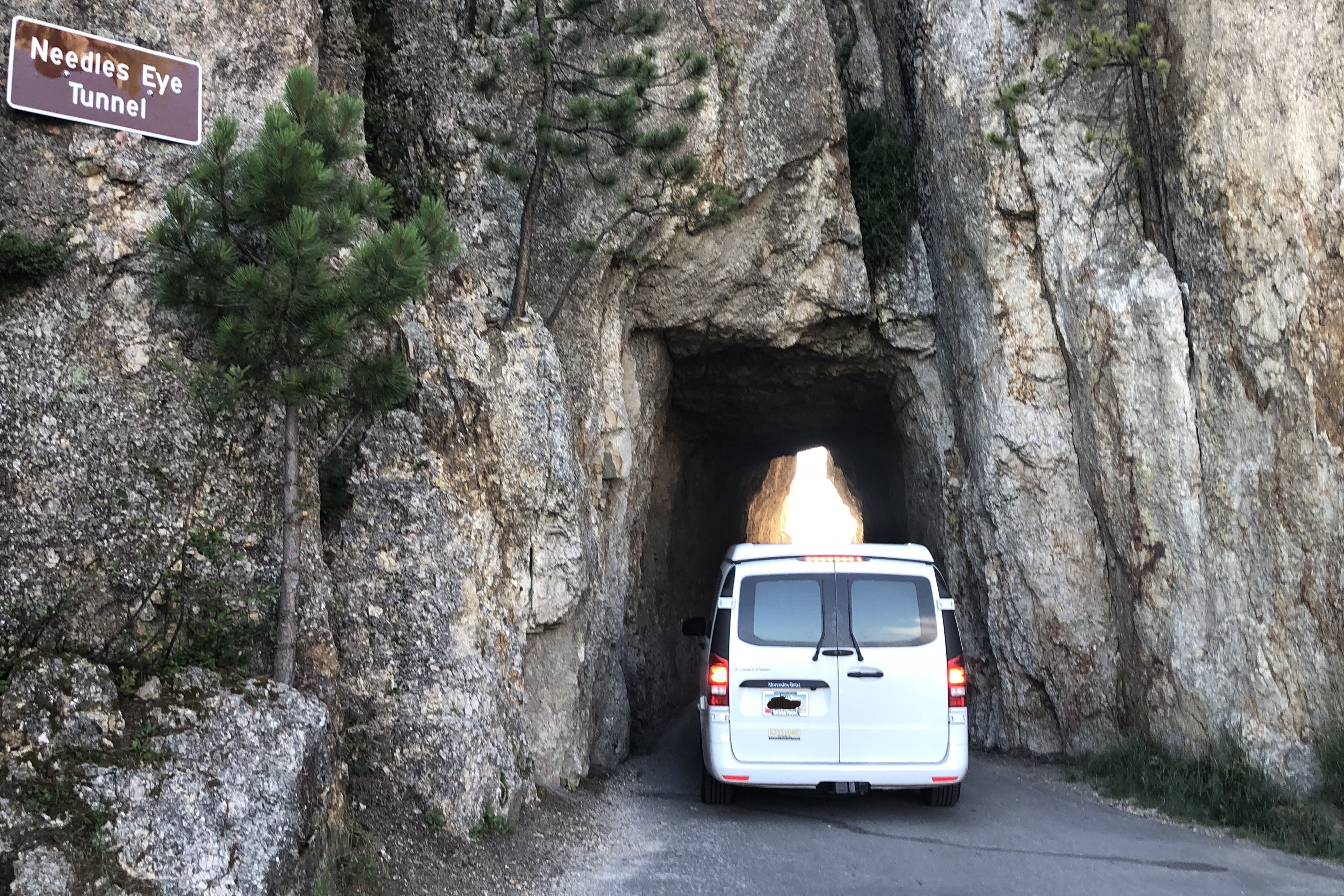
We want to go from Sylvan Lake Campground in Custer SP to Spearfish via Mt. Rushmore and I noticed there are tunnels hair pin turns & very narrow roads (google street view) that make me very nervous. Some tunnels are marked with height limits, some are not. How do I gather this info? I don’t want to turn around on a one lane road and retrace a half days drive.
Thanks
A few years ago, I bought the Rand McNally Motor Carriers Road Atlas. It includes known low clearance bridges, and tunnels in every state. It also saved me from bad GPS directions in northwest Colorado as well! I highly recommend this or similar references for anyone driving a high clearance vehicle or hauling a large trailer. GPS cannot be trusted in some places!
I don’t know about resources with this information but I will say that you probably shouldn’t attempt to drive the roads with tunnels or hairpin turns (Iron Mountain Road and Needles Highway) in Custer with anything larger than a van. We managed these roads in our 17-foot campervan and it was navigable but anything larger would likely be wider and taller and would probably be a problem. I have heard that people rent cars to drive these roads. I would suggest checking with the park for restrictions or recommendations. Good luck
There is a sectioning iRV2.com about routes and sizes of campers and how difficult it is to drive them. Some Trucker forums talk about this as well. I talked to drivers at rest stops and will be doing the same. If a long truck is going that way it is probably big enough for your rig.
I just tried Trip Wizard and it did help, to a point. Confirmed suspicions the better route from Sylvan Lake to Mt. Rushmore. Seems quite awkward to get my desired results on my first try anyway.
Then after setting my defaults, one being to avoid gravel roads, and going from Spearfish Campground to Devils Tower it took me miles & miles on a gravel road instead of a few miles further on two lane blacktop. It very well could be operator malfunction. Will try again later, but at least confirmed my fears about the tunnels.
Garmin has a RV GPS that is suppose to take that into consideration when mapping. From what I read you enter your height and length and it used that information to calculate routes. However, that probably wouldn’t be a lot of use in preparing your overall route before hand.
You can use GPS for navigation, very convenient and easy to use. I am using garmin770 and it has a lot of functions like directions, map update, bluetooth connection… Very useful.
Roads are often unreliable. You never know what surprises await you when traveling to a distant location, especially when driving. As a result, if you’re planning a week-long road trip with your family in an RV, or if you live in one, you should invest in a Garmin RV GPS. Garmin makes some of the best GPSs available, and they can be put on your RV.
I have to agree that Garmin is the top of the line. BUT they do fall short on updating their firm ware. I have a RV890 and can only use one voice, which is bad for me with my hearing issues. I have asked Garmin several times why I can’t change voices and all they ever say is that they’re aware and are working on it. Been about 2 years now with no resolution.