


Established Camping
Forlorn Lakes
About
National Forest
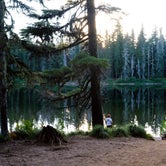
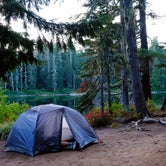
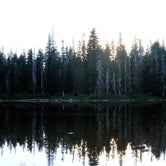
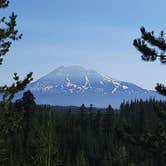
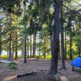
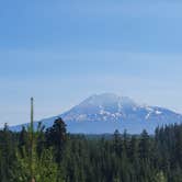
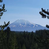
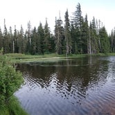
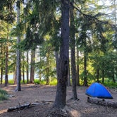
Forlorn Lakes, one of the most popular campgrounds in the southern part of the forest, offers 25 campsites scattered around the wooded shores of small, picturesque lakes. Swimming and fishing are possible in the larger lakes. Huckleberry bushes grow in the campground and surrounding area making this site very popular during huckleberry season. The campsites at a maximum 18 feet long are suitable for tent camping and small campers or RV's. The day use area has lake views, picnic tables, and fire rings. The campground is very popular, the camping spots fill early in the week. Forlorn Lakes offers nearby access to Indian Heaven via the East Crater Trailhead.
Access
- Drive-InPark next to your site
- Walk-InPark in a lot, walk to your site.
- Hike-InBackcountry sites.
- Boat-InSites accessible by watercraft.
Stay Connected
- WiFiUnknown
- VerizonUnknown
- AT&TUnknown
- T-MobileUnknown
Site Types
- Tent Sites
- Standard (Tent/RV)
- Group
- Equestrian
Features
For Campers
- ADA Access
- Trash
- Picnic Table
- Toilets
- Alcohol
- Pets
- Fires

 Guide
GuideBeautiful lakeside campground
Great camp spot at site 16 with lots of room for tents and two picnic tables for a large group. The private path to the lake was the best part.
Heads up there are gravel roads to get to the campground but nothing too rough.
- (4) View All

 Ranger
Great hidden spot
Stumbled upon a great spot at one of the forlorn lakes. Spot 14 Very quiet and serene location.
- (4) View All
RangerGreat spot!
Very quiet, first come first serve camp sites off the beaten path. We will be back!
Location
Forlorn Lakes is located in Washington
Directions
In Trout Lake, WA, at intersection of State Rt. 141 and Mt. Adams Rec Hwy, take Rt. 141 north 7.9 miles to Goose Lake/Forest Rt. 60 signs. Continue straight onto Rt. 60 and go 1.5 miles to "T" intersection. Turn right, staying on Rt. 60 (gravel) and go 0.1 miles to a "Y" intersection. Bear right, continuing on Rt. 60, and go 1.7 miles to an intersection and Forlorn Lakes sign. Turn left at sign onto Forest Rt. 6030 and go 2 miles to campground sign. Turn left at sign onto Forest Rt. 6040 into the campground or continue straight for another 0.2 miles to sites 22 through 25. NOTE: Forest Rt. 6030 becomes Forest Rt 6035 and is a dirt, rough, narrow roadway for last 1.8 miles.
Coordinates
45.9590002 N
121.75700097 W