


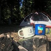
Established Camping
Spring Creek Trailhead
About
USDA Forest Service
Bridger-Teton National Forest
The trail begins with a small ATV bridge across the creek from a dispersed campsite and parking area just on the west of Greys River, about 46 miles upriver from Alpine, Wyoming. It provides motorized access for 2 miles, then becomes a horse/hiking trail that connects to the Way Trail, or over the top to Sheep Pass. Spring Creek Falls is an attraction.
Access
- Drive-InPark next to your site
Stay Connected
- WiFiUnknown
- VerizonUnknown
- AT&TUnknown
- T-MobileUnknown
Site Types
- Tent Sites
- Group
- Equestrian
Features
For Campers
- Picnic Table
- Phone Service
- Alcohol
- Pets
- Fires

 Legend
Solitude !
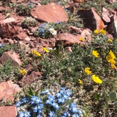
Great dispersed camping area. Appears to be used by a lot of hunters. There is a nice big picnic table at one site and a few spots with campfire rings and meat poles. There are no other amenities. The Greys River is right near camp as well as Spring Creek. The Spring Creek Falls trailhead has a river crossing at the 2 mile mark, sign states it is 5 miles to the falls. I didn’t venture further than that. I stayed at this campground because I was hiking up Wyoming Peak in the morning. Wyoming Peak was a wonderful hike, highly recommend! This summer has had the most amazing wildflowers!

- (11) View All
Location
Spring Creek Trailhead is located in Wyoming
Directions
From the Town of Afton, Wyoming, head south on United States Highway 89 (US-89) for approximately 14 miles and turn left onto Smiths Fork Road/Forest Service Road 10072 (FS-10072). Continue on FS-10072 for 23.5 miles to the Tri-Basin Divide. Turn left (North) at the junction onto Greys River Labarge Road/FS-10138 and drive approximately 9.5 miles and turn left onto Spring Creek Road/FS-10242. Continue for less than a quarter mile and take the fist right onto FS-10242A for access to Spring Creek Trailhead. Approximate travel details from the Town of Afton: 48 miles, 69 minutes.
Coordinates
42.64838348 N
110.66474975 W