


Free Camping Collection
Established Camping
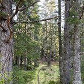
Slab Camp/Deer Ridge Trailhead
About
USDA Forest Service
Olympic National Forest
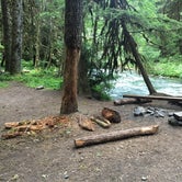
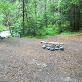
A three unit rustic camping area is adjacent to the parking area.
Provides access to:
Slab Camp Trail #838 - This forested trail descends 3.1 miles to the canyon floor and Gray Wolf River and 5.8 miles to the park boundary via Upper Gray Wolf Trail #834. Slab Camp Trail now serves as the main access to Upper Gray Wolf Trail.
Deer Ridge Trail #846 - This trail is 5.2 miles long and travels through conifer forest with views of the Olympic Peaks at higher elevations. The trail enters Olympic National Park at 3.6 miles and ends at Deer Park.
Deer Ridge and Slab Camp Trails access Buckhorn Wilderness and Olympic National Park.
Reservation Info
Permits are required for all overnight trips into the Olympic National Park backcountry.
Access
- Drive-InPark next to your site
- Walk-InPark in a lot, walk to your site.
Stay Connected
- WiFiUnknown
- VerizonUnknown
- AT&TUnknown
- T-MobileUnknown
Site Types
- Tent Sites
Features
For Campers
- Alcohol
- Pets
- Fires

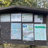
 Guide
GuideRight at the trailhead!
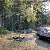
Was the only one here on a Thursday night, but decided to car camp due to the cold. There are about 5 sites with rock fire pits and a decent amount of space. A nice quiet place to spend the night even if you’re not trying to hike
- (4) View All
 Traveler
More of a trailhead
This area is more of a trailhead than a campsite. It's up some logging type roads and has a large gravel lot for parking. There are a lot of spots that you could wander into the woods and set up camp on a mossy bed under the canopy. A creek runs through on the northwest corner with a bit of flat clear ground that would make a nice campsite. There is a small road just to the north that goes to the west. There are a few suitable areas for campsites on a couple of loop trails big enough for a car.

 Legend
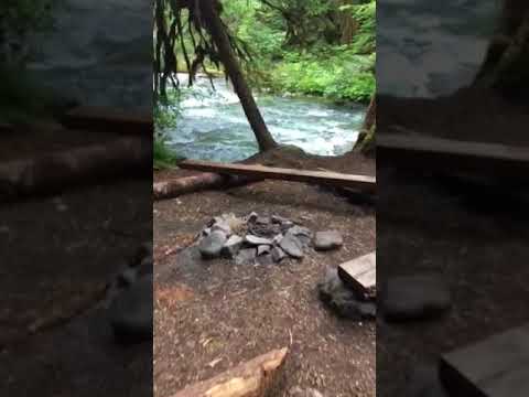
Camp Tony, 3 miles down
This backcountry Forest Service camp is 3 miles down the slab creek trail where it intersects with the Gray Wolf River. It’s a great camp with a handful of spaces with established fire pits. This camp is dog friendly, no permit necessary and absolutely free! Right on the confluence so you may need to yell at your camp buddies to be heard but it’s gorgeous and absolutely deserted. Nobody at the camp the weekend after 4th of July and in one of the most deserted river valleys in the Olympics.

Location
Slab Camp/Deer Ridge Trailhead is located in Washington
Directions
From Sequim, WA go approximately 2.5 miles west of Sequim on US Highway 101. Turn left on Taylor Cutoff Road just after crossing the Dungeness River. Follow Taylor Cutoff Road to Lost Mountain Road. Follow Lost Mountain Road for 2.6 miles. Take a slight left onto Slab Camp Road and follow for .9 miles. Turn right onto NF-2875. The trailhead is located at the end of NF-2875 after 3.6 miles, and will be at the junction of NF-2878 and NF-2875.
Coordinates
47.96511264 N
123.19327418 W