Campground photo 1
Campground photo 2
Campground photo 3

Places to Camp near Alvadore, OR

874 Reviews

Looking for the best campgrounds near Alvadore, OR? Alvadore is an adventure-filled destination for those who love the outdoorsy camper lifestyle. But it's also great for those who prefer to spend time near the city, exploring and sightseeing. Discover great camping spots near Alvadore, reviewed by campers like you.

Best Camping Sites Near Alvadore, OR (176)

  1. Camper-submitted photo from Armitage Park & Campground - a Lane County Park

    1.

    Armitage Park & Campground - a Lane County Park

    25 Reviews
    114 Photos
    185 Saves
    East Springfield, Oregon

    Located in Lane County's Eugene-Springfield metropolitan area, Armitage is a 64-acre oasis a few miles south of historic Coburg. Armitage offers visitors a full array of day use amenities including a paved boat ramp, ample trailer parking, volleyball and horseshoe pits, two dog parks (one for larger dogs and the other for smaller dogs, and several rentable large group picnic sites with electricity, cooking facilities, and drinking water.

    Its natural amenities include old growth deciduous and evergreen trees. A half-mile, self-guided interpretive trail constructed by the McKenzie Watershed Council winds through undeveloped portions of the park. Armitage is a favorite place to begin or end a boat trip, take a tranquil walk, and for large group picnic gatherings. Armitage also regularly serves as a staging area for emergency search and rescue training operations.

    Reservations are accepted both on-line, over the phone and in person. All reservations are charged a $10 reservation processing fee regardless of the modality used to reserve. Visit www.lanecountyor.gov/parks for more information and to learn about the other four Lane County campgrounds: Archie Knowles, Baker Bay, Harbor Vista and Richardson.

    • Open Year-round
    • Boat Ramp or Launch
    • Campsites (full or partial hook ups)
    • Campsites (no hook ups)
    • Caretaker/Host On Site
    • Courts
    • Festivals/Events
    • Group Campsites
    • Interpretive Feature
    • Laundry
    • Parking Lot
    • Picnic Shelter
    • Picnic Areas
    • Public Access to Waterway
    • Restrooms (portable or permanent)
    • Showers
    • Trails (hard surface)
    • Trails (soft surface)
    • Trailer Parking
    • Pets
    • Fires
    • Electric Hookups
    • Phone Service
    • Reservable
    • ADA Access

    $20 - $39 / night

  2. Camper-submitted photo from Jessie M. Honeyman Memorial State Park Campground

    2.

    Jessie M. Honeyman Memorial State Park Campground

    66 Reviews
    206 Photos
    464 Saves
    Florence, Oregon

    Situated half way up the Oregon coast and three miles south of Florence on scenic Highway 101 is the second largest overnight camp in the state. There are two miles of sand dunes between the park and the ocean. Two natural freshwater lakes are within the park. Cleawox -- which is great for swimming -- and Woahink, which has a public boat ramp, is used for all water sports. Rent a canoe and explore the lake.

    Approximately 45 full-hookup sites, more than 120 electrical sites with water, more than 185 tent sites with water nearby, 10 yurts (one pet-friendly), and six seasonal group tent camping areas.

    Hiker/biker camp Firewood for sale RV dump station Universal Access Four campsites and two yurts are accessible to campers with disabilities.

    • Pets
    • Fires
    • Electric Hookups
    • Phone Service
    • Reservable
    • ADA Access

    $21 - $36 / night

  3. Camper-submitted photo from Hult Pond

    3.

    Hult Pond

    12 Reviews
    45 Photos
    224 Saves
    Blachly, Oregon

    This site, sometimes referred to as Horton Lake, Hult Marsh, Hult Reservoir, or Mill Pond, was developed in the early 1900s for logging operations. The reservoir and surrounding wetland is about 40 acres and supports a rich diversity of wildlife, fish, and plant species. This recreation site is popular for activities such as fishing, camping, hiking, horseback riding, and scenic driving.

    • Pets
    • Fires
    • ADA Access
    • Tents
    • Dispersed
    • Picnic Table
  4. Camper-submitted photo from Tillicum Beach Campground

    4.

    Tillicum Beach Campground

    44 Reviews
    127 Photos
    676 Saves
    Waldport, Oregon

    Overview

    Tillicum Beach Campground is popular for many reasons, but the number one and most obvious is its location right on the beach. Campers are lulled to sleep by the sound of the ocean waves, then wake to sweeping views of the Pacific. The campground offers an ideal location for whale watching. Most campsites have beachfront views, and sunsets are not to be missed. Fishing, swimming and playing in the sand are the campground's most popular activities.

    Recreation

    Campers enjoy Tillicum for its expansive sandy beach. Surfers and swimmers play in the waves just off-shore. Children love building sandcastles on the beach. Walking along the beach is a great way to explore the area. Cape Perpetua is 6 miles south, where visitors can wander through old-growth Sitka spruce, experience the crashing surf, investigate tide pools, whale watch or take a guided hike. Waldport, just 4 miles north, provides access to fishing, crabbing, clamming and shrimping in the Alsea Bay and River.

    Facilities

    The campground offers several single-family campsites, a few of which have both electric and water hookups. Sites with hookups are not on the waterfront. Due to the campground's popularity, it's a good idea to make reservations in advance. Each site is equipped with a picnic table and campfire ring. Flush toilets and drinking water are provided but there are no showers.

    Natural Features

    The coastal campground lies a couple miles south of where the Alsea River meets the Pacific Ocean. Tillicum is perfectly perched on the sandy beach yet it still offers some shade. The campground offers views of both the ocean and the Coastal Range.

    Nearby Attractions

    Heceta Beach is located nearby, giving visitors the opportunity to enjoy the Pacific Ocean. Mary's Peak is the highest point in Oregon's Coast Range and has been designed a Scenic Botanical Area because of its rich, unique scenery and plants.

    • Pets
    • Fires
    • Electric Hookups
    • Phone Service
    • RVs
    • Tents

    $28 - $34 / night

  5. Camper-submitted photo from Deerwood RV Park

    5.

    Deerwood RV Park

    9 Reviews
    5 Photos
    43 Saves
    East Springfield, Oregon
    • Pets
    • Electric Hookups
    • Phone Service
    • Reservable
    • ADA Access
    • RVs
  6. Camper-submitted photo from Alsea Falls Recreation Site (campground)

    6.

    Alsea Falls Recreation Site (campground)

    8 Reviews
    35 Photos
    144 Saves
    Alsea, Oregon

    Overview

    Reserve a site at Alsea Falls on recreation.gov or pay when you arrive for non-reserved campsites using the Recreation.gov Mobile App. You must download before you reach the site since there is no cell reception in the drainage.__ Alsea Falls Recreation Site is located along a Bureau of Land Management National Back Country Byway, located in the Oregon Coast Range, 13 miles west of Monroe, Oregon, in Benton County. Alsea Falls is open for camping the first weekend in May through the end of September of each year. Day use is open year round. The South Fork of the Alsea River flows through the Alsea Falls Recreation Site, cascading down 30 feet to form Alsea Falls in the day use area.

    Recreation

    The beautiful surroundings of Alsea Falls can be enjoyed by exploring the trails that wander through the area and lead to the picnic grounds and beyond. On a warm day, Alsea Falls Recreation Site offers cool relief along the river. During the winter months, the South Fork of the Alsea River provides excellent salmon and steelhead fishing. Be sure to check with the Oregon Department of Fish and Wildlife for current fishing regulations.

    Facilities

    This recreation area has 16 individual campsites; all are reservable. No first come-first served availability, however, you can come by on a nightly basis to camp if the site is not reserved until the reservation holder arrives. Amenities within the campground include drinking water and vault toilets. Several campsites can accommodate large RVs or trailers: up to 32 feet long. A site map is available here.__

    Natural Features

    Forests in all stages of growth line South Fork Alsea National Back Country Byway. The nearby South Fork Alsea River offers painters and photographers endless opportunities to capture the natural beauty of Alsea Falls and the surrounding area. Old growth Douglas fir and western red cedar forests can be seen on the nearby ridges, while younger Douglas fir and vine maples provide a pleasant atmosphere at the Alsea Falls Recreation Site.

    Nearby Attractions

    The Fall Creek Day-Use Trailhead offers over 12 miles of mountain bike specific trails. Hikers can use these trails as well. Green Peak Falls with a drop of 45 feet is accessed by road or trail through the private campground of McBee Park. Follow the markers along the trail and road. Alsea Trout Hatchery is north of the town of Alsea.

    contact_info

    This location has limited staffing. Please call (503) 375-5646 for general information.

    Charges & Cancellations

    Standard fees apply and are non-refundable. Visit https://www.recreation.gov/rules-reservation-policies for more information.

    • Pets
    • Fires
    • RVs
    • Tents
    • Standard (Tent/RV)
    • Trash

    $40 / night

  7. Camper-submitted photo from South Twin Lake Campground

    7.

    South Twin Lake Campground

    6 Reviews
    26 Photos
    61 Saves
    Eugene, Oregon

    Overview

    South Twin Lake Campground sits on the shores of South Twin Lake, a small lake adjacent to the much larger Wickiup Reservoir.

    Recreation

    South Twin Lake provides visitors with the opportunity for fishing, swimming and paddling. Motorized boating is not permitted.

    Facilities

    This facility has sites that can accomodate, tent, trailer or RV campers. Each site comes with a picnic table and is equipped with a fire ring. This campground offers potable water and flush toilets, as well as, a nearby boat launch area leading to the water. Boat launch parking is for day use only and requires a recreation fee separate from camping fees.__

    Natural Features

    The lake was formed about 20,000 years ago when rising magma-encountered groundwater resulting in violent steam explosions. The resulting explosions formed a broad shallow crater, which later filled with water. The lake covers an area of 99 acres with average depth of 33 feet with a maximum depth of 58 feet. South Twin Lake is a lure's toss from the Deschutes arm of Wickiup Reservoir and less than a mile south of North Twin lake.

    Nearby Attractions

    Visitors can explore wilderness areas, rivers, lakes and reservoirs, and approximately hundred of miles of trail. Newberry National Volcanic Monument, approxiately 45 minutes by vehicle, is a great starting point for visitors to learn about the diverse landscape and history of the area through interpretive programs and exhibits. Visitors can explore Lava River Cave, the longest continuous lava tube in Oregon. Visitors enjoy traveling the Cascade Lakes Scenic Bywaywhich climbs 66 miles through the Cascade Range, weaving past snow-capped peaks and alpine lakes.

    Charges & Cancellations

    Once your reservation start date has begun, neither the Recreation.gov Contact Center nor the campground manager will be able to modify your reservation.

    • Pets
    • Fires
    • Phone Service
    • RVs
    • Tents
    • Group

    $25 - $58 / night

  8. Camper-submitted photo from Premier RV Resort at Eugene

    8.

    Premier RV Resort at Eugene

    5 Reviews
    6 Photos
    24 Saves
    East Springfield, Oregon
    • Pets
    • Electric Hookups
    • Phone Service
    • Reservable
    • ADA Access
    • RVs
  9. Camper-submitted photo from Whittaker Creek Recreation Site

    9.

    Whittaker Creek Recreation Site

    10 Reviews
    74 Photos
    99 Saves
    Walton, Oregon

    Overview

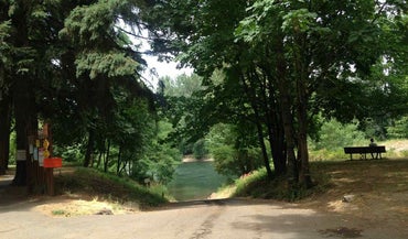
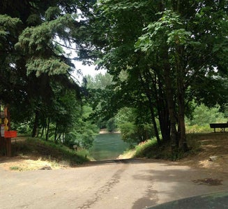
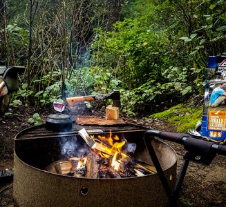
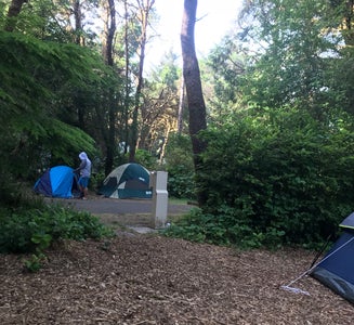
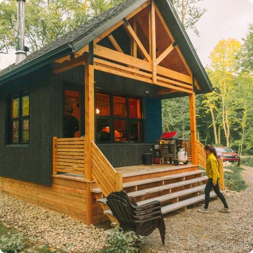
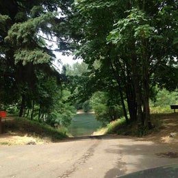
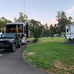
    Partial Temporary Closure of Campsites Whittaker Creek Campground will have a short temporary closure of camp sites 16-31 while we remove invasive species that are threatening the natural ecosystem within the park. As the sites are cleared and safe to utilize, we will open them for use on a rolling basis starting with the westernmost sites.____ Reserve a site at Whittaker Creek on recreation.gov or pay when you arrive for non-reserved campsites using the Recreation.gov Mobile App. You must download before you reach the site since there is no cell reception in the drainage.__ Whittaker Creek Recreation Site is a Bureau of Land Management (BLM) campground and day use area. The campground has 30 sites. Campground amenities include vault toilets, potable water, picnic areas, a children's play area, an Old Growth Ridge National Recreation Trail (2.5 miles), and a swimming area.__ In the fall, winter, and spring, busloads of middle school students visit the Whittaker Creek Watchable Wildlife Site to learn about spawning salmon and trout and to assist with the Oregon Department of Fish and Wildlife's breeding program.__

    Recreation

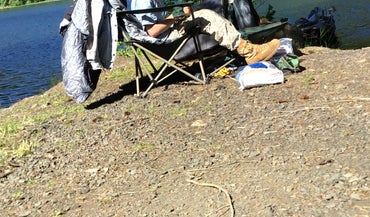
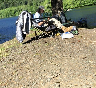
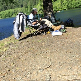
    Camping, hiking, swimming, fishing in Siuslaw River, photography, hunting, Salmon Watch, and nature study.

    Facilities

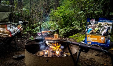
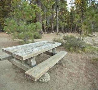
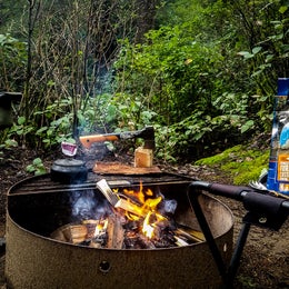
    Facilities include: 30 tent only campsites (not recommended for trailers), an accessible campsite, 2 picnic sites, accessible vault toilets, potable water available from hand pumps, picnic tables, fire rings, swimming beach area (June-September), horseshoe pit, Old Growth Ridge National Recreation Trail (2.5 mile loop trail), and a camp host (June-September). Electricity and firewood are unavailable.

    Natural Features

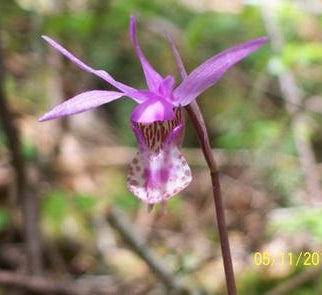
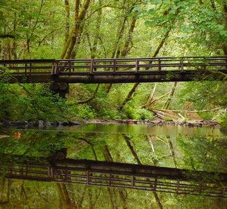
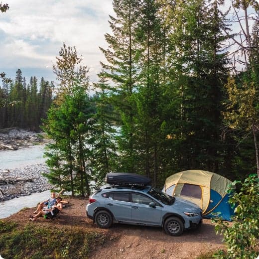
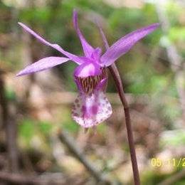
    Besides the trail to the wildlife viewing area, you can hike the Old Growth Ridge National Recreation Trail, which climbs 1,000 feet above the river into the Coast Range. The 2.5-mile trail was designated in 1994 as a National Recreation Trail due to the exceptional wildlife, geologic features, and old growth trees that are typical of coast range ecosystems. This moderately difficult trail winds through a stand of old growth Douglas fir and offers a look at geologic and botanical features unique to the area. Chinook and coho salmon, as well as steelhead trout can be observed in the fall and winter months in the creek next to the campground. The site also features a paved boat ramp that provides drift boat and canoe access to the Siuslaw River. No permit required to paddle the 6.5-mile river, with Class II - III rapids.

    contact_info

    For local information, please call (541) 683-6600 or call (503) 375-5646 for general information.

    Nearby Attractions

    Clay Creek Campground, is approximately 16 miles past Whittaker Creek. The Oregon Coast is less than 30 miles from this recreation site. (Florence) Alder Dune Campground (Florence) Archie Knowles Campground (Florence) B & E Wayside Mobile and RV Park (Cottage Grove) Baker Bay Campground (Dorena) Baker Bay County Park (Westfir) Bedrock Camp You can observe Chinook, and Coho salmon, as well as steelhead trout in the fall and winter months in the creek next to the campground during Salmon Watch.

    Charges & Cancellations

    Standard fees apply and are non-refundable. Visit https://www.recreation.gov/rules-reservation-policies for more information.

    • Pets
    • Fires
    • Electric Hookups
    • Phone Service
    • RVs
    • Tents

    $20 / night

  10. Camper-submitted photo from Carl G. Washburne Memorial State Park Campground

    10.

    Carl G. Washburne Memorial State Park Campground

    30 Reviews
    114 Photos
    425 Saves
    Yachats, Oregon

    Washburne is located on the east side of Highway 101 with a buffer of native plants and trees between you and the highway. The campsites are spacious and are available on a first come first served basis except for the two yurts which are reservable. There are several trails of varying difficulty leading from the campsites to the beach, wildlife viewing areas, and second-growth forests.

    A walking trail leads you under the highway to a five-mile sandy beach and a day-use area, where you'll find space to watch whales, hunt agates, beachcomb, and picnic. Another trail connects you to the Heceta Head trail, which you can use to reach the historic Heceta Head lighthouse.

    In the campground at night, you can hear the pounding surf. There is a creek running through the campground, and elk have been known to wander through. Wild rhododendrons bloom in spring.

    Campground info:

    Approximately 50 full-hookup sites More than five electrical sites (with water) Seven walk-in tent sites (closes seasonally October - April) Hiker/biker camp Two yurts Flush toilets and hot showers RV dump station in day-use area Firewood for sale Universal Access Site #30 is accessible to campers with disabilities.

    • Pets
    • Fires
    • Electric Hookups
    • Phone Service
    • Reservable
    • ADA Access

    $34 / night


Popular Camping Styles near Alvadore

Pet-friendly camping near Alvadore

Recent Reviews In Alvadore

874 Reviews of 176 Alvadore Campgrounds