Campground photo 1
Campground photo 2
Campground photo 3

Places to Camp near Crandall, GA

1,359 Reviews

Join the fun near Crandall. With tons of outdoor activities and scenic camping, this is an excellent vacation spot for all kinds of travelers. There are tons of hikes and other fun activities to partake in. Experience some of the most stunning views that Georgia camping has to offer. Find the best campgrounds near Crandall, GA. Read helpful reviews and tips to find the perfect camping option for you and your crew.

Best Camping Sites Near Crandall, GA (411)

  1. Camper-submitted photo from Fort Mountain State Park Campground

    1.

    Fort Mountain State Park Campground

    56 Reviews
    359 Photos
    402 Saves
    Chatsworth, Georgia

    Fort Mountain State Park is a place of legends. Literally! Home to an mysterious, ancient, rock wall at the peak of a mountain, Fort Mountain’s associated legends include the construction of a Welsh military fort, a honeymoon destination for native newlyweds, and a relation to “moon-eyed people” of Cherokee folklore. Whatever the truth may be, there is no denying that this park’s unique features have made it one of the major draws within the Chattahoochee National Forest.

    Located just a short scenic drive off of Highway 52 near the Cohuatta Wilderness, the campground at Fort Mountain State Park hosts 70 campsites for tents and RVs. Campers can bring their paddles to take advantage of all 17 acres of Fort Mountain Lake, or take part in the local rental program for easier travels.

    While there is no need to leave the park to find adventure, many campers take a short drive east to a historic site featuring the Chief Vann House. This well-preserved structure was the first Cherokee brick residence and is often referred to as the “showplace” of the Cherokee Nation. Continue your travels to the peak of Fort Mountain where you can take a tour of a stone fire tower built by the Civilian Conservation Corps during the Great Depression. Enjoy panoramic views and marvel at the legendary beauty of Fort Mountain State Park.

    • Pets
    • Fires
    • Electric Hookups
    • Phone Service
    • Reservable
    • ADA Access
  2. Camper-submitted photo from Cloudland Canyon State Park Campground

    2.

    Cloudland Canyon State Park Campground

    122 Reviews
    630 Photos
    895 Saves
    Trenton, Georgia

    Resting on the western edge of northwest Georgia’s Lookout Mountain, Cloudland Canyon State Park is more than 3,000 acres—one of the state’s largest parks—of rugged geology, and offers visitors hiking, camping, rock climbing and more along the park’s most iconic feature: the deep gorge cut through the mountain (elevation varies from 800 to more than 1,800 feet!) by the Sitton Gulch Creek. Multiple waterfalls and cascades, including the uber-popular Hemlock Falls, can be found throughout the gorge, making this park feel like a hidden gem around Lookout Mountain.

    Staring at the geographic anomaly isn’t the only thing to do at this park, however. Beyond the countless miles of hiking, biking and horse riding trails, geology fanatics can find rock climbing, rappelling and spelunking across the park—cave tours are even offered for beginning cave explorers at Sitton’s Cave.

    The park holds a massive variety of camping options, including 72 spots suitable for both tent and RV campers, 30 walk-in sites, 13 dispersed sites, 16 cottages and 10 yurts, each in a different area of the park. With this many options, campers can find seclusion all around.

    • Fires
    • Electric Hookups
    • Phone Service
    • Reservable
    • RVs
    • Cabins

    $65 / night

  3. Camper-submitted photo from Harrison Bay State Park Campground

    3.

    Harrison Bay State Park Campground

    54 Reviews
    179 Photos
    274 Saves
    Harrison, Tennessee
    • Pets
    • Fires
    • Electric Hookups
    • Phone Service
    • Reservable
    • ADA Access

    $22 - $28 / night

  4. Camper-submitted photo from Amicalola Falls State Park Camping
  5. Camper-submitted photo from Chilhowee Recreation Area

    5.

    Chilhowee Recreation Area

    23 Reviews
    130 Photos
    251 Saves
    Benton, Tennessee

    Overview

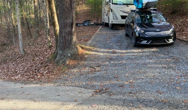
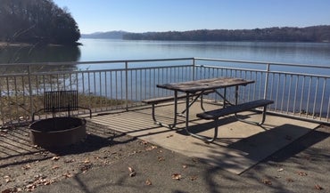
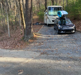
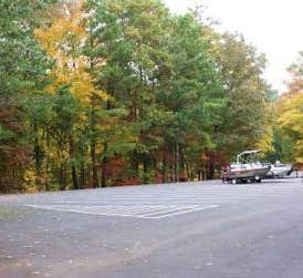
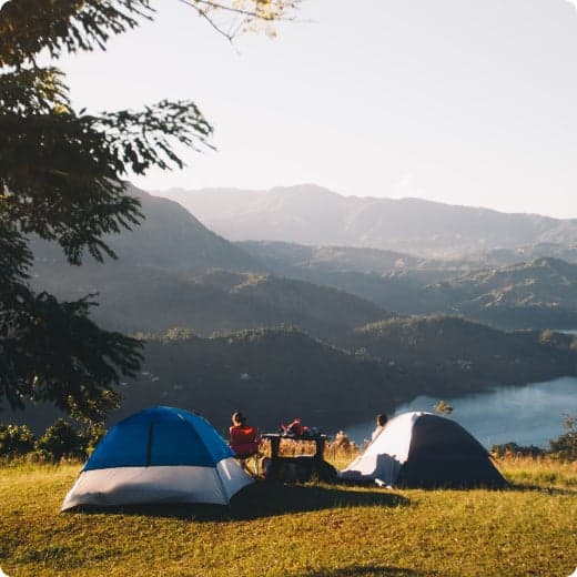
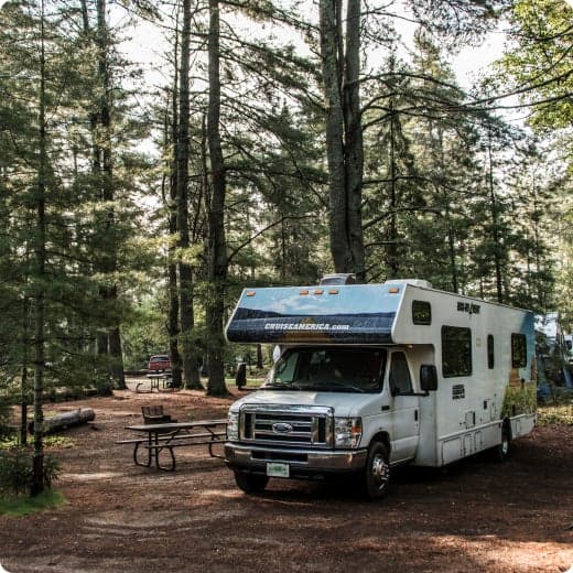
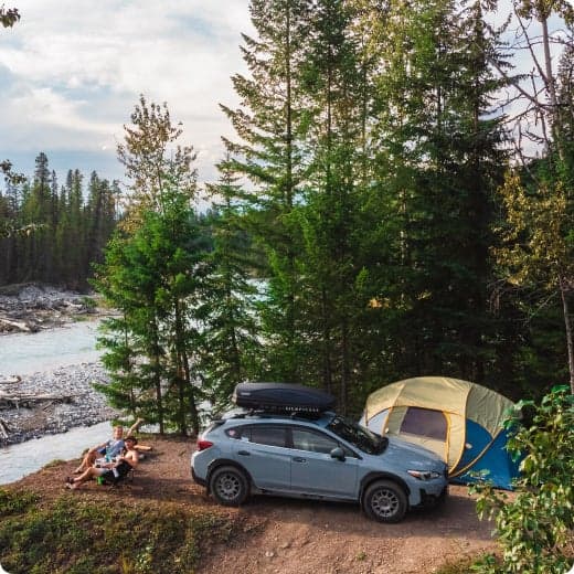
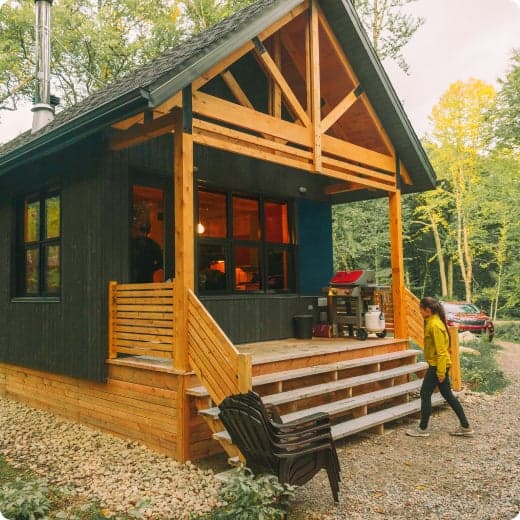
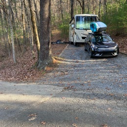
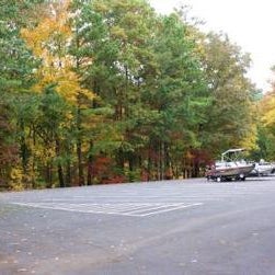
    Located in the Chilhowee Recreation Area, Chilhowee Campground offers a multitude of camping opportunities for both RV and tent sites, many with electric hookups. The day-use area includes McKamy Lake, a swim area with sand beach, picnic sites, a group picnic area, and a bathhouse.__ Be Aware; Do not use GPS directions: GPS coordinates will direct you up Benton Springs Rd. This route is not recommended. We recommend using Forest Service Road 77 to reach the recreation area. It's important to note, this facility requires driving 7 miles up to Chilhowee Campground on a narrow, winding road. Do not use the Benton Springs Access Road to the campground as this is an unpaved and dangerous road for RVs. Inexperienced RV drivers may have difficulties getting to and around the site.

    Recreation

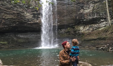
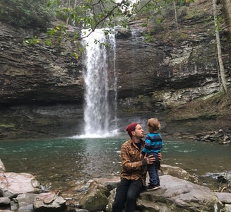
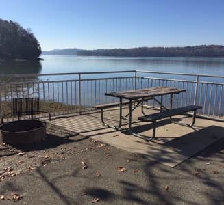
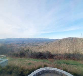
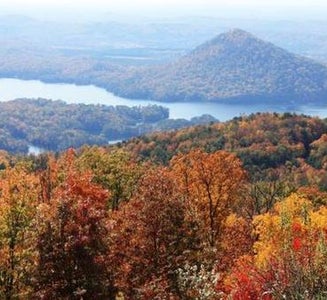
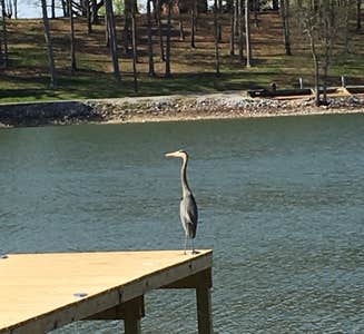
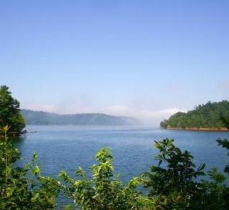
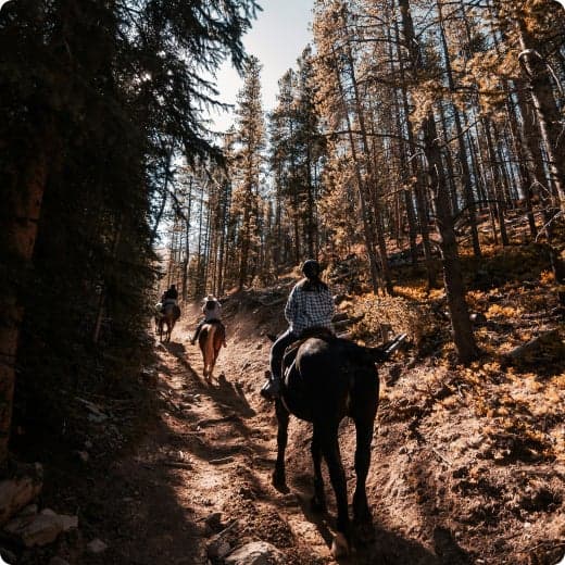
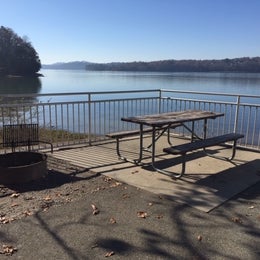
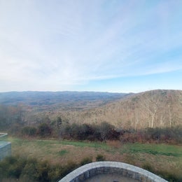
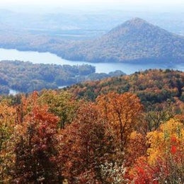
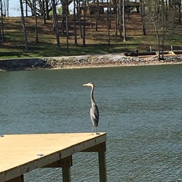
    Chilhowee Recreation Area is an excellent hub for hiking and mountain biking in the Chilhowee Trails System, fishing in McKamy Lake, and wildlife viewing without having to get in your car. The 7-acre McKamy Lake offers a swim area with a sand beach, and fishing from the bank. Boats are allowed, but gasoline motors are not. Within the recreation area are approximately 25 miles of hiking and biking trails, and a scenic waterfall. The views and lake are beautiful, especially hiking to Benton Falls via a 1.5 mile in and out moderate trail. On the drive up to the campground, stop at one of the many observation overlooks to see beautiful mountain settings. Wildlife is abundant in this area, so have your camera ready and tread lightly.__ Chilhowee Recreation Area Map and Guide____

    Facilities

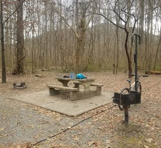
    Picnic tables, grills, and lantern posts are located at each site. Bathhouses providing flush toilets and warm showers are available in each loop, as well as in the day use area. Water hydrants are located throughout the campground. An RV dump station is located at the end of E Loop. Loops A and B offer walk-in tent sites with electricity.Be Aware; Do not use GPS directions: GPS coordinates will direct you up Benton Springs Rd. This route is not recommended. We recommend using Forest Service Road 77 to reach the recreation area. It's important to note, this facility requires driving 7 miles up to Chilhowee Campground on a narrow, winding road. Do not use the Benton Springs Access Road to the campground as this is an unpaved and dangerous road for RVs. Inexperienced RV drivers may have difficulties getting to and around the site.____

    Natural Features

    The Cherokee National Forest is located in eastern Tennessee and stretches from Chattanooga to Bristol along the North Carolina border. The 650,000-acre swath of land is Tennessee's only national forest. It lies in the heart of the Southern Appalachians and is home to more than 20,000 species of plants and animals, as well as many rivers, creeks and lakes.__

    Nearby Attractions

    In addition to the immediate local activities, world class whitewater rafting opportunities are nearby on the Ocoee and Hiwassee Rivers.

    • Pets
    • Fires
    • Electric Hookups
    • Phone Service
    • RVs
    • Tents

    $20 / night

  6. Camper-submitted photo from Doll Mountain Campground

    6.

    Doll Mountain Campground

    19 Reviews
    105 Photos
    201 Saves
    Talking Rock, Georgia

    Overview

    Doll Mountain Campground is located in the North Georgia Mountains on beautiful Carters Lake, Which is just a short 70 miles north of Atlanta. Carters Lake provides clean, safe, and quiet campgrounds that help you escape the hustle and bustle of your day to day routine and relax with your family. Doll Mountain offers boating, picnicking at the day use area, and many other summer time activities.Doll Mountain, one of the larger campgrounds offering 68 campsites to choose from.The majority of them are RV hook ups, so you can enjoy the great outdoors while remaining comfortable with your family. Doll Mountain also provides easy access to the water with its own boat ramp and boat trailer parking area.Facilities include, play ground, and two large, restrooms with showers. Doll Mountain guarantees a pleasant camping experience and several summer activities for the whole family to enjoy.

    Recreation

    Boaters visit Carters Lake to enjoy its solitude and scenic beauty. Whether in a powerboat or sailboat on the open water or paddling along the shoreline in a canoe, Carters Lake offers enjoyable boating experiences for everyone. Fishing is a popular activity on the lake. Major species include bass (largemouth, smallmouth, hybrid, striped and spotted) crappie, walleye, bream and catfish. Bank fishing locations are limited due to steep shoreline terrain, but six boat ramps are scattered around the shoreline, offering easy access to the lake.

    Facilities

    The heavily wooded campground contains RV and tent-only sites, many of which have electric hookups. Flush toilets, showers and drinking water are provided. Additional amenities include a children's playground and a dump station.

    Natural Features

    Carters Lake embraces a spectacular tract of foothills scenery in the Blue Ridge Mountains of north Georgia. It covers 3,200 surface acres and has 62 miles of undeveloped shoreline.

    contact_info

    For local information, please call (706) 276-4413 or call (706) 334-2248 for general information.

    Nearby Attractions

    Ridgeway Park and the Woodring Branch Recreation Area are each located within a 45-minute drive from Doll Mountain Campground. Hiking and mountain biking trails in each park offer beautiful scenery and a mix of easy to challenging terrain.

    • Pets
    • Fires
    • Electric Hookups
    • Phone Service
    • RVs
    • Tents

    $28 - $100 / night

  7. Camper-submitted photo from Chester Frost Park
  8. Camper-submitted photo from Gee Creek Campground — Hiwassee/Ocoee Scenic River State Park
  9. Camper-submitted photo from Thunder Rock Campground

    9.

    Thunder Rock Campground

    19 Reviews
    92 Photos
    140 Saves
    Reliance, Tennessee

    Overview

    Thunder Rock Campground is located 1.8 miles northwest of the Ocoee Whitewater Center, just behind TVA Ocoee Powerhouse Number 3. Nestled alongside the Ocoee River, this facility provides 37 regular campsites for popups and RVs less than 20 feet with no elctricity , ONLY site 9 is an electric site for less than 20 feet at 30 amp, and one group campsite. Thunder Rock is a popular destination for both whitewater and trail enthusiasts.__

    Recreation

    Trailhead parking is available for the nearby Tanasi trail system, which includes approximately 30 miles of hiking and mountain biking trails. This system can be reached via Thunder Rock Express, Dry Pond Lead, or the Rhododendron Trail. Thunder Rock also provides access to the Benton-McKaye Trail.

    Facilities

    Picnic tables, grills, and lantern posts are located at each campsite. Water hydrants are located throughout the campground. Bathhouses provide flush toilets and warm showers. The campground host is located at the campground entrance next to the main bathhouse. Thunder Rock Campground Map and Guide__

    Natural Features

    The Cherokee National Forest is located in eastern Tennessee and stretches from Chattanooga to Bristol along the North Carolina border. The 650,000-acre swath of land is Tennessee's only national forest. It lies in the heart of the Southern Appalachians and is home to more than 20,000 species of plants and animals, as well as many rivers, creeks and lakes.

    Nearby Attractions

    The nearby Ocoee River put-in and Ocoee Whitewater Center, home of the 1996 Olympic Canoe/Kayak-Slalom Competition, makes this an ideal location for rafters and kayakers alike.

    Charges & Cancellations

    All sites have a $18.00 cancellation and reservation fee.____

    • Pets
    • Fires
    • Electric Hookups
    • Phone Service
    • RVs
    • Tents

    $15 / night

  10. Camper-submitted photo from Woodring Campground

    10.

    Woodring Campground

    13 Reviews
    51 Photos
    156 Saves
    Ellijay, Georgia

    Overview

    Woodring Branch Campground is located in the North Georgia Mountains on the beautiful Carters Lake Project, which is just a short 70 miles north of Atlanta. Carters Lake provides clean, safe, and quiet campgrounds that help you escape the hustle and bustle of your day to day routine and relax with your family. Woodring Branch offers boating, hiking, mountain biking, picnicking at the day use area, and many other summer activities. Woodring Branch has two different loop style trails from from easy to moderate. Amadahy and the Oak Ridge Nature trail will ensure a great family hiking experience as they both include a wide diversity of plants, animals, and scenic views. The campground has 2 boat ramps with limited boat trailer parking spaces for all your boating needs. Woodring branch at Carters Lake has something for everyone, no matter what your hobbies are.

    Recreation

    Boaters visit Carters Lake to enjoy its solitude and scenic beauty. Whether in a powerboat or sailboat on the open water or paddling along the shoreline in a canoe, Carters Lake offers enjoyable boating experiences for everyone. Fishing is a popular activity on the lake. Major species include bass (largemouth, smallmouth, hybrid, striped and spotted), crappie, walleye, bream and catfish. Bank fishing locations are limited due to steep shoreline terrain, but six boat ramps are scattered around the shoreline, offering easy access to the lake. The Amadahy Trail is located in the Woodring Branch Recreation Area. This 3.5-mile loop is excellent for beginners with flat to rolling terrain. Bikers and hikers are treated to beautiful views of Carters Lake along most of trail's length.

    Facilities

    This heavily wooded campground offers many sites with scenic lake views. Electric hookups are available at many of the campsites. Flush toilets, showers and drinking water are provided. Additional amenities include a children's playground and a dump station. A boat ramp and swimming area are on-site.

    Natural Features

    Carters Lake embraces a spectacular tract of foothills scenery in the Blue Ridge Mountains of North Georgia. It covers 3200 surface acres and has 62 miles of undeveloped shoreline.

    contact_info

    For local information, please call (706) 276-6050 or call (706) 334-2248 for general information.

    Charges & Cancellations

    Please review rules and reservation policies at the bottom of the page.

    • Pets
    • Fires
    • Electric Hookups
    • Phone Service
    • RVs
    • Tents

    $20 / night


Popular Camping Styles near Crandall

Pet-friendly camping near Crandall

Recent Reviews In Crandall

1359 Reviews of 411 Crandall Campgrounds