Campground photo 1
Campground photo 2
Campground photo 3

Places to Camp near Harriet, AR

627 Reviews

The Dyrt is here to help plan your best camping near Harriet. Aside from great camping spots, you'll find hiking and many more outdoor experiences. Thinking of traveling with kids? You're in luck—Harriet is surrounded by family-friendly activities. At The Dyrt, campers like you share their favorite spots, plus tips and photos. No matter where you're headed in Harriet, you'll find the best spot for you and your camping crew.

Best Camping Sites Near Harriet, AR (169)

  1. Camper-submitted photo from Buffalo Point — Buffalo National River

    1.

    Buffalo Point — Buffalo National River

    30 Reviews
    139 Photos
    219 Saves
    Cozahome, Arkansas

    Overview

    Buffalo Point is a convenient, fun-filled destination for families and adventurists of all types. It's perched along the Buffalo National River, providing exciting river sports and hiking opportunities. In peak season, a restaurant is open at the facility, serving up meals for those who want a break from preparing them.

    Recreation

    The wild river is a gathering place for water activities. Many campers spend their days fishing, hiking, canoeing or kayaking. Evenings are ideal for gathering next to the fire to revamp for another great day out on the river.

    Facilities

    Buffalo Point offers campsites with water, electricity and even a classic pay telephone. It's the only area in the park with a restaurant, open daily from Memorial Day to Labor Day and on weekends only from mid-April to Memorial Day Weekend and Labor Day Weekend to mid-October.

    Natural Features

    The campground is set along Buffalo National River, one of the few free-flowing rivers remaining in the contiguous United States. The river runs 135 miles without dams and cuts through the Arkansas Ozarks and into the White River. The region is surrounded by droves of lush hardwood trees and grassy open meadows.

    Nearby Attractions

    Two popular attractions within the Buffalo Point Area are the Indian Rockhouse Trail and the Rush Historic District. Rush was a zinc mining community until the zinc market collapsed and the settlement was deserted. Tours about the town's history are available. Buffalo Point is the former Buffalo River State Park developed in the 1930's as project of the Civilian Conservation Corps. Blanchard Springs Caverns, an extraordinary living cave, is a one-hour drive from Buffalo Point.

    Charges & Cancellations

    Please see the Recreation.gov Rules and Reservation Policies.__

    • Pets
    • Fires
    • Electric Hookups
    • RVs
    • Tents
    • Group

    $50 / night

  2. Camper-submitted photo from Blanchard Springs Campgrounds

    2.

    Blanchard Springs Campgrounds

    24 Reviews
    101 Photos
    253 Saves
    Fifty-Six, Arkansas

    Overview

    Blanchard Springs Recreation Area is located in the scenic Ozark National Forest. The Ozark Mountains are known for beautiful "rolling" hills, hidden caverns, waterfalls and clear flowing streams. Examples of early Ozark culture and music can be found throughout the region. Blanchard recreation area is a great starting point for an Ozark adventure.

    Recreation

    Trout fishing is available on nearby Mirror Lake. Other popular activities in the Blanchard area include mountain biking, hiking and swimming.

    Facilities

    The campgrounds offer a variety of campsites to accommodate all types of visitors, including group and single campsites. All sites are equipped with tables, grills and campfire rings. Individual sites are on a first come, first served basis. The individual sites are open except when there is high water. To check campground status, call 870 757 2211. The picnic shelters have grills and ample picnic tables for groups. Flush toilets and drinking water are provided.

    Natural Features

    The facilities are near picturesque rock bluffs and crystal clear streams. Sites are well shaded by stately yellow pine trees.

    Nearby Attractions

    Blanchard Springs Caverns offers tours, exhibits and family activities. North Sylamore hiking trail follows the scenic Sylamore creek for 25 miles and connects to the Ozark Highland trail. Mountain biking is available on 50 miles of the Syllamo Mountain Bike Trail.

    • Pets
    • Fires
    • Electric Hookups
    • RVs
    • Tents
    • Group

    $15 / night

  3. Camper-submitted photo from Bull Shoals-White River State Park

    3.

    Bull Shoals-White River State Park

    25 Reviews
    129 Photos
    112 Saves
    Bull Shoals, Arkansas

    This recreation area is part of Bull Shoals Lake

    • Pets
    • Fires
    • Electric Hookups
    • Phone Service
    • Reservable
    • ADA Access
  4. Camper-submitted photo from Gunner Pool Recreation Area

    4.

    Gunner Pool Recreation Area

    13 Reviews
    64 Photos
    159 Saves
    Fifty-Six, Arkansas

    Overview

    This location is available on a first-come, first-served basis only. Visitors are required to physically arrive at the campground to purchase and claim a site. Once on-site, you may be able to pay for your campsite(s) by scanning a QR code using the Recreation.gov mobile app, and the Scan and Pay feature. If this option is available, you will need to first download the free Recreation.gov mobile app https://www.recreation.gov/mobile-app prior to your arrival as some remote areas have limited or no cellular service.

    • RVs
    • Tents
    • Group
    • Standard (Tent/RV)
    • Trash
    • Drinking Water
  5. Camper-submitted photo from Richland Creek Recreation Area

    5.

    Richland Creek Recreation Area

    17 Reviews
    71 Photos
    238 Saves
    Witts Springs, Arkansas

    Overview

    This location is available on a first-come, first-served basis only. Visitors are required to physically arrive at the campground to purchase and claim a site. Once on-site, you may be able to pay for your campsite(s) by scanning a QR code using the Recreation.gov mobile app, and the Scan and Pay feature. If this option is available, you will need to first download the free Recreation.gov mobile app https://www.recreation.gov/mobile-app prior to your arrival as some remote areas have limited or no cellular service.

    • RVs
    • Tents
    • Group
    • Standard (Tent/RV)
    • Trash
    • Toilets
  6. Camper-submitted photo from Blue Heron Campground

    6.

    Blue Heron Campground

    9 Reviews
    12 Photos
    33 Saves
    Cotter, Arkansas

    Blue Heron Campground provides the pleasure of a natural Ozark setting without leaving the beaten path.

    Forget about traveling miles of back roads to reach that special camping spot. Our RV park is just off the highway and right on the banks of the White River, a premier trout fishing destination.

    This is RV camping at its finest. You can fish, bird watch, or simply enjoy the Ozark Mountains scenery.

    • Pets
    • Fires
    • Electric Hookups
    • Phone Service
    • Reservable
    • ADA Access
  7. Camper-submitted photo from White Buffalo Resort

    7.

    White Buffalo Resort

    6 Reviews
    15 Photos
    98 Saves
    Norfork, Arkansas
    • Pets
    • Fires
    • Electric Hookups
    • Phone Service
    • Reservable
    • ADA Access
  8. Camper-submitted photo from South Maumee Camping Area — Buffalo National River

    8.

    South Maumee Camping Area — Buffalo National River

    5 Reviews
    14 Photos
    67 Saves
    Buffalo National River, Arkansas

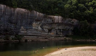
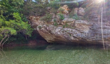
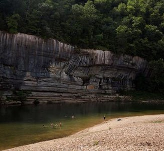
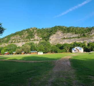
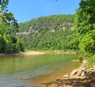
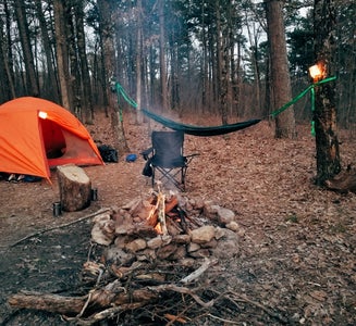
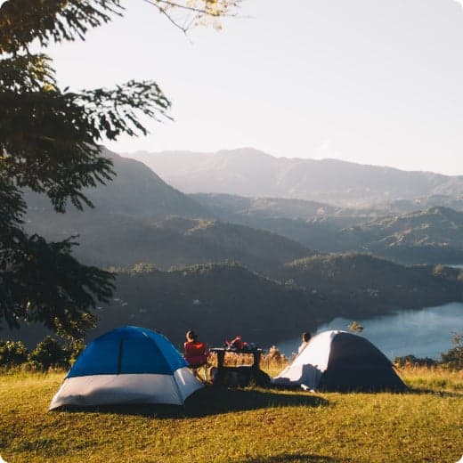
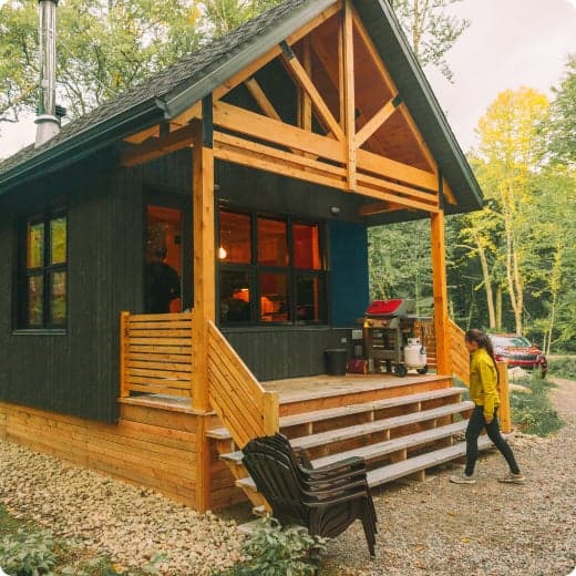
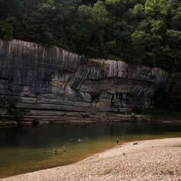
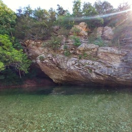
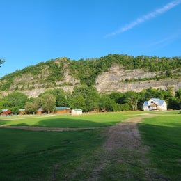
    Located in northern Arkansas, the Buffalo River flows for 153 uninterrupted miles, from its origin in the Ozarks’ Boston Mountains eastward to its confluence with the White River. In 1972, the Buffalo was designated America’s first National River, and is currently managed jointly by the US Forest Service and the US National Park Service. Over the course of its journey, the Buffalo passes sandstone and limestone bluffs, mixed upland forests, and flows through three wilderness areas: Upper Buffalo, Ponca, and Lower Buffalo. Along the river are more than 12 campgrounds, as well as primitive camp areas, which provide a variety of options for taking advantage of the area’s numerous hiking trails, as well as rafting, paddling and fishing on the river.

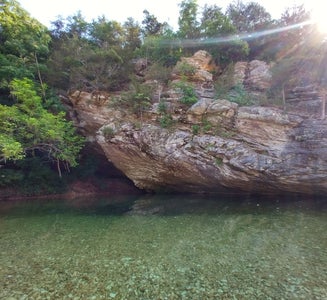
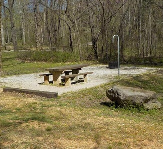
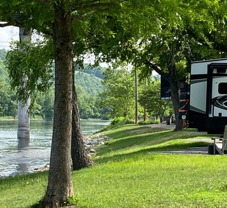
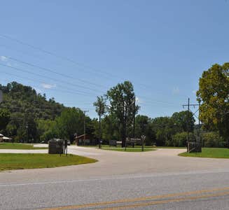
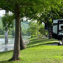
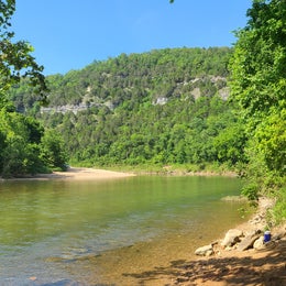
    Accessible via a 7-mile gravel road from the small town of Morning Star, on Highway 27, South Maumee Campground offers five free, first-come, first-served campsites. Each site is equipped with picnic tables, fire rings and lantern posts. A vault toilet is available, but no trash service, so campers need to pack out all garbage; hookups are not available at this location. The campground is situated on a wide, sandy bend on the Buffalo River, so river access is easy for swimming and fishing, however there is no boat launch. A boat launch is available at the North Maumee Campground, on the other side of the river, and accessible via Highway 14. In addition to river recreation, there are 14 miles of hiking trails in the area for exploring an old mining townsite, an indigenous peoples’ bluff shelter, and scenic viewpoints.

    • Pets
    • Fires
    • Electric Hookups
    • Phone Service
    • Reservable
    • ADA Access
  9. Camper-submitted photo from Sam's Throne Recreation Area
  10. Camper-submitted photo from Dam - Quarry

    10.

    Dam - Quarry

    9 Reviews
    41 Photos
    26 Saves
    Norfork, Arkansas

    Overview

    Dam Quarry Campground is an angler's paradise. Located in northern Arkansas, just downstream of the Norfork Dam, the campground is renowned for its world-class trout fishing. The Norfork Lake region was one of the state's first water recreation areas with opportunities like water skiing, canoeing, scuba diving, and of course, fishing.

    Recreation

    While fishing is the top-rated activity in the lower river area, kayaking, birding and hiking are also very popular. The public land around Norfork keeps hunters busy with white-tailed deer, wild turkey, squirrel, rabbit and quail.

    Facilities

    Kids will enjoy the playground and everyone will find fun in the water. A boat ramp is on-site and a marina is located just above the dam. Everything but the group sites have electric hookups.

    Natural Features

    The campground sits at the banks of the North Fork River and Dry Run Creek. The river feeds the popular 22,000-acre Norfork Lake, which is just upstream from Dam Quarry. The site has beautiful views of the forested hills and hollows of the Ozarks.

    Nearby Attractions

    A short drive south takes visitors to the Ozark National Forest for sightseeing and wildlife spotting. The campground is also just three miles northeast of the small town of Norfork.

    Charges & Cancellations

    Cancellations up to 2 days before a reservation start date incur a $10.00 cancellation fee.

    • Pets
    • Fires
    • Electric Hookups
    • Phone Service
    • RVs
    • Tents

    $50 / night


Popular Camping Styles near Harriet

Pet-friendly camping near Harriet

Recent Reviews In Harriet

627 Reviews of 169 Harriet Campgrounds